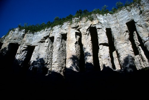
 Sometime back in the 70s, I heard that the Marquette cement plant was going to blow the caves that had been made to quarry limestone in the days before heavy equipment made removing overburden easy. (Click on any photo to make it larger.)
It might have been The Missourian’s story with a whole page of Fred Lynch photos on Page 6 that tipped me off. Here’s the link to the story about the caves. You’ll have to page back to see his pictures.
Pitched story to architectural magazine
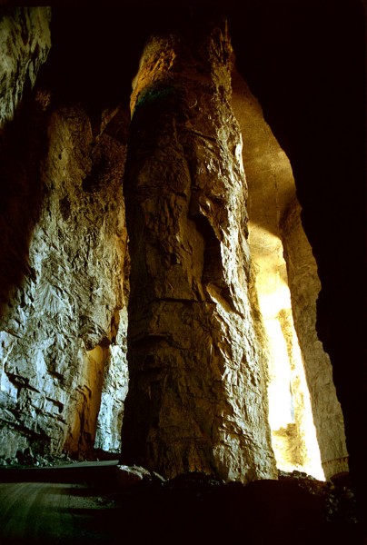 I pitched the story idea to an architectural magazine. They wouldn’t give me an assignment, but they said they’d look at whatever I shot. I don’t recall if they eventually turned the story down or if I never got around to submitting it to them. I think it was the latter.
So, the Kodachrome slides spent 30-plus years in storage, where the color shifted slightly.
Edward Hely founded company in 1904
 The Missourian’s story said that Edward Hely started the stone company in 1904; it bore his name until 1931, when it became the Federal Materials Co. The quarry was known as the Blue Hole because of the color of the water when it filled up.
Marquette Cement bought the property in 1976.
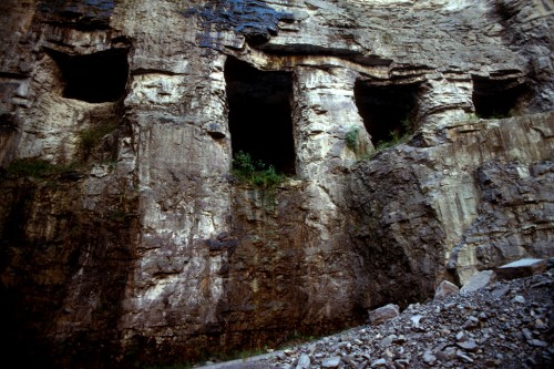 By the time Marquette Cement bought the property in 1976, the two quarries were separated by just about 100 feet, most of which was taken up by a network of caves. Federal Materials found it easier to dig horizontally to extract the limestone than to remove 35 to 50 feet of overburden – earth and lower grade stone – to get to the rock.
When the tunneling stopped, the quarry was about 375 feet deep. The pillars averaged 150 feet in height and were 35 to 45 feet in diameter.
Caves collapsed in 1981
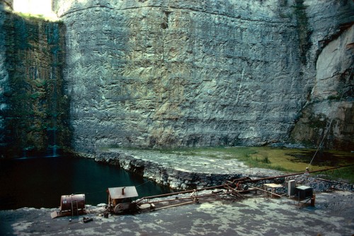 In its May 17, 1981 edition, The Missourian pulled out all the stops to cover the collapse of the caves. Fred captured the action and reporter John Ramey wrote a first-person account of seeing a million tons of rock collapse on itself. The story said that crews spent two months drilling 850 blast holes and loading them with 600,000 pounds of dynamite. Some of the deepest 200-foot holes contained as much as 1,400 pounds of dynamite.
You could walk a long way
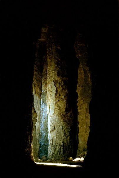 Present-day Buzzi Unicem plant manager Steve Leus was part of the team that handled the blast. When he gave me a tour of the plant and the quarry last fall, he said, “I was in the caves myself. It was massive. You could walk a long way before you came to the end of that cave.”
Columns were massive
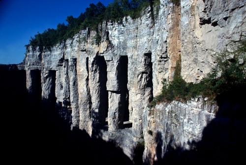 “The columns were massive,” he continued. “They had to be to hold up that roof.”
They way they mined in those days, he explained, was “they drilled into the side of the limestone, then they blasted, then they mucked it out. Basically what they ended up doing was tunneling.”
You wouldn’t make that mistake twice
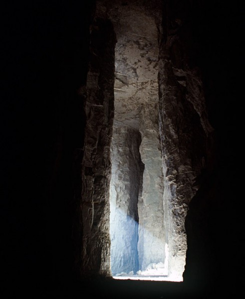 “They had a feel for what size column to leave to support the roof, and, if they didn’t, they didn’t make that mistake twice,” Leus said.
Some of the tunnels are under Sprigg
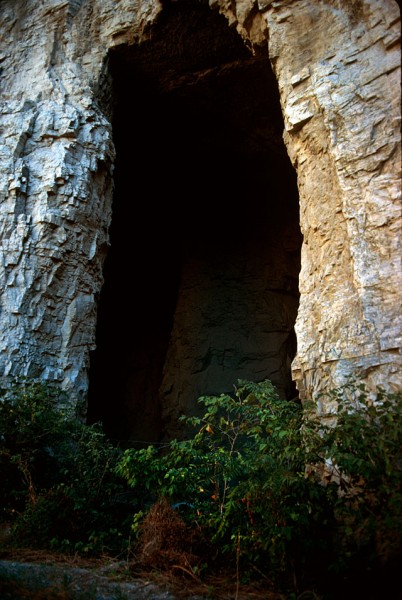 Leus pointed out some of the tunnels that extend under Sprigg Street. “We don’t know how far back they go,” he said. Present-day safety regulations make it complicated to enter what is considered a mine, so no one in recent history has explored the caves. (I’ll have pictures of those in the future.)
Seep water poured down sidewalls
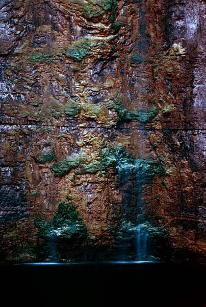 Ground water would find its way into seams and leak down the walls of the quarry. Pumps would send it on its way through underground pipes until it made it back to the Mississippi River.
Quarry was about 375 feet deep
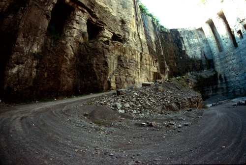
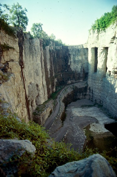 When Marquette Cement acquired the Federal Materials quarry, the deepest part was about 375 feet deep. Access to to the bottom was over rough, steep and curving haul roads.
Shafts of light and darkness
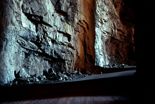 You were constantly moving into areas of shade and darkness when you drove along the haul road and through the caves.
Enough stone for another 10-15 years
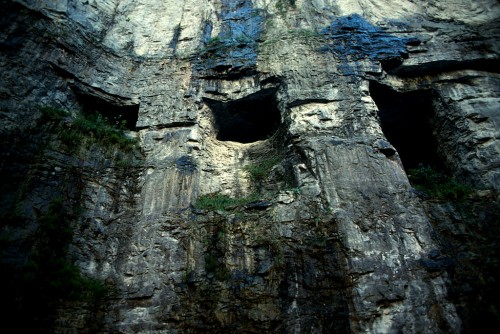 Leus said there is enough stone in the quarry to last for another 10-15 years. They’re expanding to the north and west now since they’ve gone just about as deep as practical at this point.
A 1981 story estimated the reserves would last about 30 years, so either production has slowed or more rock is being extracted than predicted. The cement plant owns property near Scott City that could be mined in the future.
A place of beauty
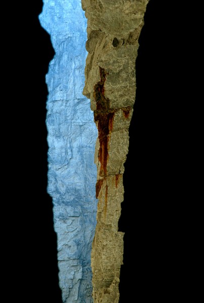 There was something to shoot in every direction. This made me think of the grand canyon.
A shame to lose them
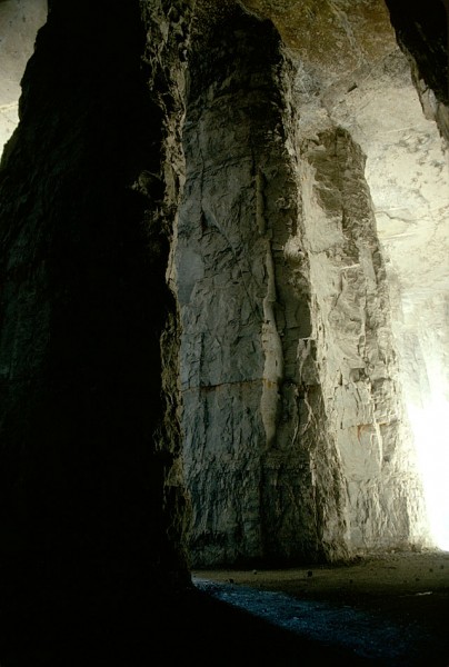 It was a shame to lose these beautiful features, but safety regulations would bar anyone from seeing them today, so it may be better that the stone was turned into the Bill Emerson Memorial Bridge and roads and buildings in the region.
More photos to come
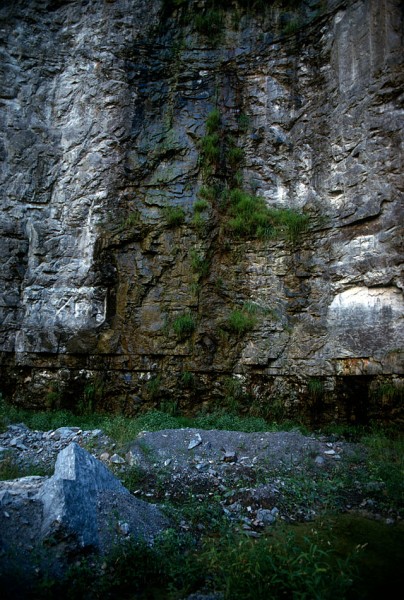 I’ll have more photos of the quarry and the cement plant taken last fall. Some of the photos from the 9th floor of the plant show spectacular views all the way to Academic Hall. The day was so clear that Crowley’s Ridge was visible in the distance.

Really nice pictures! I can remember having the cement dust on the car every morning, they finally cleaned it up and stopped the dust. I also remember Mr. Cook lived across the street from us and they would come by in an old cement covered car to pick him up for work. I don’t think the car ever got a car wash..
My Great grandfather Cook worked there and passed away in his very early twenties do to the many years of debris that filled his lungs.
When a child, I remember my grandfather (who worked at the cement plant,) telling us about a cemetery that was on top of the ground and in back of the quarry as it was in those days. (I am not sure if he meant the main quarry or the Blue Hole quarry.) He said that, along with others, a former Missouri governor was buried there. The quarry has expanded so much since then, I wonder if the cemetery is still there. Does anyone know?
Paul,
I did a couple of quick searches. The cemetery doesn’t show up on some topographic maps I checked. If you can give me any idea which governor or any piece of the cemetery name, then I might be able to find out.
Dad used to drive up a gravel (barely) road behind the Blue Hole BBQ that would take us up to the hill overlooking the Blue Hole Quarry to buy fishing worms from The Worm Man. It was one scary ride to the top and back down.
I don’t recall seeing a cemetery up there, but I was probably too young for one to register with me.
These are gorgeous photos!
Beautiful pictures and story! Really enjoyed !I remember as a kid when we drove by, I would try to see the very bottom of the quarry.Thanks!
Jesse, I think my father may have been the driver of that car!! He picked up 3 to 5 people on a regular basis so their cars didn’t have to get fitlthy. Once ro twice I remember him “washing” it with an acid, but it didn’t last long. That was strictly a work car and my dad drove it for his errands. My mom and I rode in the other car that was not allowed to be driven to the plant. That one also stayed in the garage because anything outside of cover was covered in dust all over town!
Ken the pictures are beautiful. Amazing what an “ugly hole” can contribute to beauty!
Ken, those are some beautiful and probably one day, historic photos. I hope you can find a place to have the preserved as part of Cape’s history.
Thanks, one Ken to another.
I’m in discussion with the Special Collections folks at SEMO. They seem to be interested in picking up my stuff at some point after I’ve grown cold.
Well, truth be told, they’d probably take it earlier, but I’m not quite ready to give it up yet.
Ken, any new photos of the caves since your last post?
No. They don’t exist, except for the ones under Sprigg, and I doubt that anyone will be allowed to explore them due to newer safety regulations.
Reader Keith Robinson sent me a sequence of photos when the caverns were blown.
Thank you so much for linking Keith’s photos. Beautiful!
Do you have any information on the newer safety regulations you mentioned? Was this something implemented recently?
Can anyone confirm the rumor that strategic materials were placed in the caves during WWII, and if so, what were the materials?
DNR map of Cape County cemeteries does not show any in the area of the quarrys. I have never heard of one, especially with a Missouri governor buried there. I know the family referred to by someone as the “worm man.” The father worked for Federal Materials. I have driven up the small gravel road which I think is no longer there or at least passable. Family, named Stone (really), moved many years ago. I do know that the Hunze family sold land about 5 years ago (I’m thinking like 40 acres), on the west side of the main quarry. The quarry is expanding in that direction.
Do you know anything about the old house and barn out there? There’s also a brick building that looks like an old schoolhouse.
Back in the day when it was Marquette Cement, Dad took us down in the quarry and out to the kiln. It seem like there was a family day too. All the Stones I am kin to, worked at the cement plant. Dad was with Marquette 42 years until he retired in 1982.
The cement dust was a problem. Back in the early 50s the guys would drive model As and Model Ts to the plant and saved their new 1950s model vehicles from the dust. Among the plant vehicles I remember Dad had was a 1914 Hudson touring car and a 1929 Model T coupe. Those cars in those days had little or no value. There were garages you could rent from the plant to save your car from the dust. I don’t remember how well that helped. Even with the dust collectors, it seemed like there was always dust. My first car was a 1951 Chevrolet I called the gray ghost. It was forever rusting out and I was forever patching it, using whatever primer was available. I never did paint the gray ghost but then it never quit rusting.
Paul: I found a news clipping from 1926 saying that Missouri Governor Wilson Brown was buried south of Cape Girardeau at the “east end of old rock levee road.” This might be what your grandfather was talking about.
A Google search reveals that Wilson Brown was actually a Lt. Governor who died in office in 1855.
Here’s a link to the Southeast Missourian news clipping.
James,
Thanks for helping out. Your link was broken, so I repaired it.
Here is the story James mentioned about Wilson Brown.
By the way, if you aren’t a regular reader of his blog in The Missourian, you’re missing some good stuff.
Faulous photos and great story. I was told the the Common Pleas courthouse in Cape has the oldest concrete in Missouri – I’m sure the cement plant here was the reason.
Ken.. The Missourian story about the collapsing is a little off….
My father (Burl Medlock) was in charge of the quarry at the time. We didn’t know anything about the collapsing til the evening before, and then he told us to stay off the phone and not tell anyone. It was a big secret.
They didn’t use dynamite, it was Dupont Tovex, a very modern explosive gel. Very experimental at the time.
At that time, it was the largest conventional explosion ever done. Broke all kinds of records.
Next time your in Cape I’ll travel back and show you Dad’s photo album of the entire process.. And a couple stories about it that are pretty funny.
Scott Medlock
Scott,
Thanks for clearing that up. I’m always a little uncomfortable when newspaper folks write about technical subjects.
Keith Robinson sent me some photos of the blast. I’d like to use them some time in the future, with your permission.
When I toured the plant and quarry last fall, Steve Leus, the plant manager, said that your dad had stopped in a few days earlier. He was effusive in his praise of Burl. And, of course, your dad and mine were friends through Scouts.
I’ll be back in Cape at the end of June / first part of July.
Ken, when is the last time you were able to check out the caves? You have been the only source of info I have ever came across in my few years of investigating this site. Hope you have been well. Would love to see your pictures from inside the pipeline someday!
Here’s a post I did about the quarry from the top.
I DID shoot pix from the bottom of the quarry in 2010, and was sure I did a post on it, but it’s not showing up in the search. I’ll post a link when I run across it.
Did you ever come across that old post from the bottom?
Ken, thanks for a great story. I was always fascinated by the quary. I love the pictures you sent.. Keep up the great work.
Great story and pictures, thank you.
My grandpa, Tom Yow, worked at the quarry. I’m not sure what years those would have been. My dad was born in 1914 so probably somewhere around that time. We lived on South Sprigg in the late 50’s – early 60’s and our car & everything else was coated with cement dust. It was a ‘gritty’ existence but we were accustomed to it.
My grandpa, Tom Yow, worked at the quarry. I’m not sure what years those would have been. My dad was born in 1914 so probably somewhere around that time. We lived on South Sprigg in the late 50’s – early 60’s and our car & everything else was coated with cement dust. It was a ‘gritty’ existence but we were accustomed to it. Great photos, Ken! I never knew there were caves back in there.
Are any of these caves still there or are they all gone now?
All of the ones pictured are gone. There are a few that go south and under Sprigg Street that still exist, but no one is allowed to go in them for safety reasons.
You can see them in the seventh photo down on this page.
So these pictures are of the main quarry hole
when it was smaller?
Yes and no. When they blew the caves, they made it possible to mine the stone that made up the floors and columns. When all that rock was gone, then, yes, the hole became bigger, but the overall outside dimensions of the quarry didn’t expand much, if any.
When I shot that photo a couple of years ago, we were about 350 feet down. That’s about as deep as it is going to go. I’ve noticed they’ve started dumping overburden down there, which indicates they are moving to the north and west.
I was told there is about another 10 years worth of rock in that quarry.
Hi Ken. As usual, your photos are stunning!! I lived in the south end of Cape as a child and I remember the quarry sending messengers to the close neighborhoods to tell the residents the days and times they would be blasting so we could be prepared. When the blasts came, preceded by a loud horn blast, the houses would shake and dishes in the cupboard would rattle! I also remember going for a Saturday drive with the family and we always made sure to drive by the quarry so we could “see” the bottom!! I am so glad that you have such great documentation/photos on the history of Cape. I guess that would officially make you Cape Girardeau’s “Living Time Capsule”. Thanks for all your posts and photos. Keep them coming!!! 🙂
Down memory lane! It was my privilege to be a mining engineer with Marquette Cement 1973-1983 and was involved with the pit design that collapsed the caverns. As I recall, getting that extra territory allowed for a haul road to the lower levels. Unfortunately I was not there for the big blast. Great pics.
Hello. I am a designer working on a book for the Smithsonian Institute on the History of American Food. I came across a photo you shot at the Trinity Lutheran School cafeteria in 1967 that we’d like to include as part of the story of school lunch programs. If you can help me with this please contact me. Thx
I sent you an email.
Has there been any updates or new information come to rise regarding the mine/caves?
I haven’t done anything recently, but here’s a post from 2014 that has some links to earlier posts.