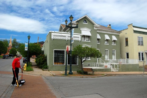
Themis and Spanish Landmarks

This green stucco building at the northeast corner of Spanish and Themis was the Doyle’s Hat Shop I mentioned in the story about my grandmother, Elsie Adkins Welch. She would ride a wagon from Advance to Cape to buy a new bonnet there.

A Missourian column, Lost and Saved provides some historical background: The two-story brick stucco building, designed with Italianate influences served as the residence of Elizabeth Doyle and as her business, the Doyle Hat Shop. The hat shop was located in the southwest corner of the building with the house adjoining. Mrs. E.W. Harris, aunt of Doyle, started the hat shop in 1859 and, when she passed away in 1908, Doyle took over the family business. Doyle had a pet fox terrier named Dan and, when he died in 1922, it made the newspaper that she was in mourning over losing her beloved pet. When Doyle died in 1925, her daughter in-law, Mrs. E.M. Doyle, ran the business. The hat shop closed in 1960.

Teen Age Club
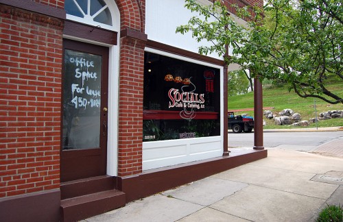
Teens from the 1960s will recall walking through this door and going up to the Teen Age Club located on the second floor.

Officials shut down dance
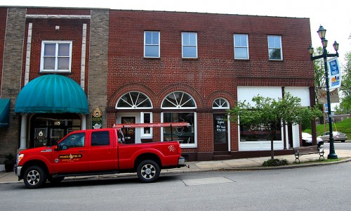
This is the building where the kids were gyrating so enthusiastically the floor started bouncing Officials shut down the dance before the building could collapse.

Dancing in the parking lot
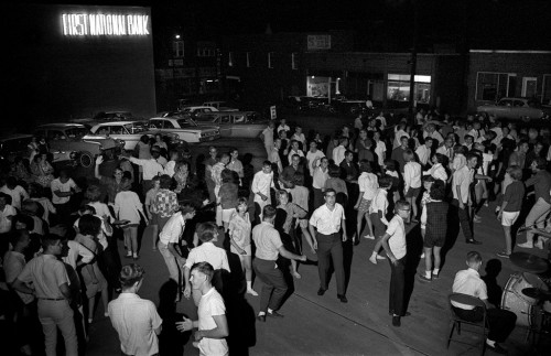
Not to be deterred, the teens moved out to the bank parking lot at the corner of Broadway and Main. Follow the link to see more photos.

Common Pleas Courthouse
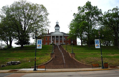
If you look up the hill to the west, you’ll see the Common Pleas Courthouse overlooking the downtown area.

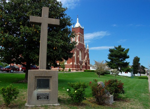
Cape La Croix Creek Marker

As long as I can remember, a simple concrete cross stood at the intersection of Kingsway Drive and Kingshighway. I have to admit that I knew it had to do with something historical, but I wasn’t exactly sure what.

Still, it disturbed me that something that had been a Cape Girardeau landmark since 1947 would be displaced in 2009, so a commercial building could be built and some public land swapped around.

I was looking for a couple of other landmark monuments Thursday when I ran across my old friend, the cross, at the corner of William and South Main, on the grounds of the St. Vincent de Paul Catholic Church.

Cross relocated on Good Friday

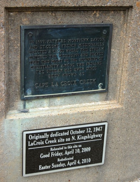
A new plaque says the monument was originally dedicated Oct. 12, 1947 at the LaCroix Creek site on N. Kingshighway. Relocated to this site on Good Friday, April 10, 2009 and rededicated Easter Sunday April, 4, 2010.

The original plaque says, “In 1699, Fathers Montigny, Davion and St. Cosme, French missionaries, erected a cross where this stream entered the Mississippi and prayed that this might be the beginning of Christianity among the Indians. The stream has ever since been known as Cape La Croix Creek.”

I find it interesting that one monument could have two different spellings for the name of the stream that it recognizes: Cape La Croix Creek and LaCroix Creek.

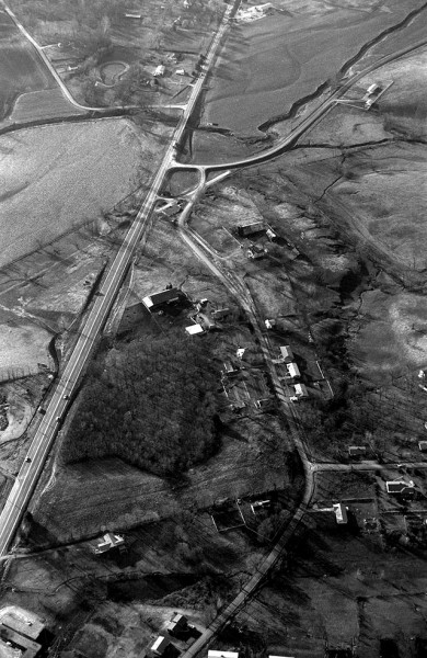
Kingsway and Kingshighway 1966

Kingshighway is on the left. Kingsway is on the right. At one time, the road that went by the names Old Jackson Road and 3-Mile Creek Road met Kingshighway at a 45 degree angle. State guidelines required that intersections should meet at 90-degrees, so the road was curved slightly to the west.

The monument was located in the dark brush area just west of the old intersection of Old Jackson Rd. and Kingshighway.

The area has changed drastically. Kurre Lane, at the bottom right, has been extended to Kingshighway and a fire station sits on the corner. The two farms and their barns have been torn down. The cow pastures we used to look over have homes planted on them.

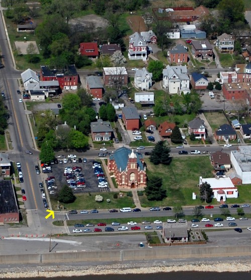
Cross on St. Vincent’s grounds 2011

The cross now lives on the southeast corner of the St. Vincent de Paul Catholic Church grounds (marked by the yellow arrow). The Red House is at the bottom of the photo and the Jewish Synagogue is the white building with red trim on the lower right.

If the original intent was to mark the meeting of Cape LaCroix Creek and the Mississippi River, I guess the new location is probably about as close to the actual spot as the 1947 location.

Still, it bugs me that a landmark was uprooted for what appears to be someone’s commercial gain.

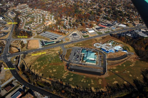
UPDATE Kingsway-Kingshighway in 2010

Some folks asked what’s at the Kingshighway-Kingsway intersection today.

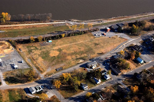
Here is an aerial photo I shot Nov. 6, 2010. It’s almost easier to list what’s NOT there. A Plaza Tire store is about where the cross stood. The large building complex at the bottom is the Osage Center; the new water park was under construction to its right. Storage units and a housing development cover what used to be two farms and their fields.

Isle Casino Cape Girardeau Clearing Starts

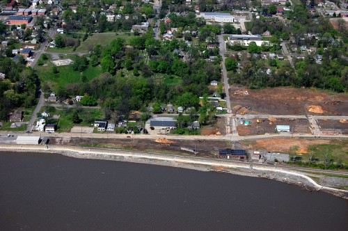
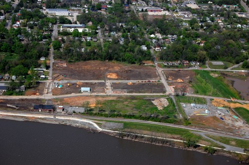
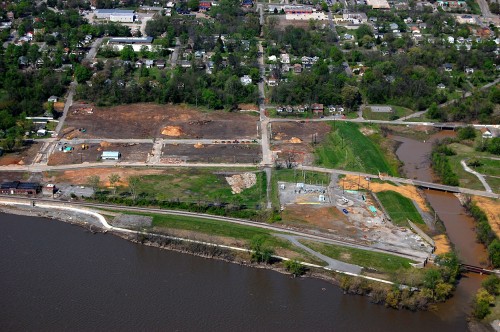
When I flew over the site of the old shoe factory in November of last year, the Isle Casino Cape Girardeau was an abstract idea. When I flew over it April 17, buildings had been knocked down, scores of trees had been turned into a mountain of mulch and land was being cleared.

This is the south end of the project. Main Street runs left to right at the bottom of the photo. Mill Street is in the middle, running East-West. The first three photos were taken from over the Mississippi River looking to the west.

Old Lorimier Cemetery is the wooded area with the white tombstones showing in the left center of the picture. Click on any image to make it larger.

Trees are all that remain of Washington School

This photo is bracketed by Mill Street on the left and Mason on the right. The half-street in the middle used to be Pearl Street.

A parking lot and a few trees are all that’s left of the old Washington School, located between Mill and Pearl Streets. Look for a blue-roofed building and white parking lot. The trees east of it are where the school used to be. It was razed by the university, not as part of the casino project.

Mill Street to Sloan Creek

Heavy rain and storms have turned Sloan Creek muddy. You can see the flood gates that can be closed, blocking rail traffic when the river is flooding.

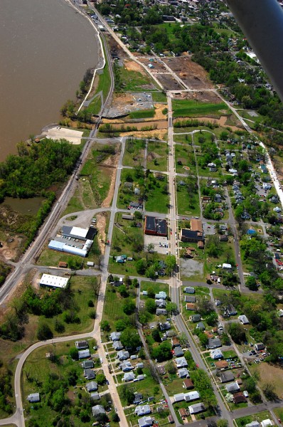
Red Star looking South

Here’s a view of the Red Star District looking south toward the direction of the casino site. The concrete pad on the left is Red Star Access, what used to be called Honker’s Boat Dock.

Red Star, once a vibrant community with many residents employed at the shoe factory, suffered one too many floods in 1993. Most of the homes in the flooded area were bought out and only open space remains.

Shoe factory site November 2010

Here are two links to several earlier stories, including more information about this photo.


What’s With the Clock?

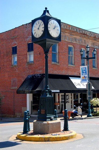
This may be heresy, but I’m just gonna have to say it: What’s the big deal with the clock in the middle of Main Street?

When I was downtown the other day, I realized that I had never photographed the clock on purpose Is it because it wasn’t there when I was growing up, so I don’t have fond memories of dodging it (like the person who knocked down the bollards didn’t do)?

A plaque on the side says it was “Dedicated this 19th day of June, 1986 (they left out the comma) to the City of Cape Girardeau by the Cape Girardeau Downtown Redevelopment Authority”

Why is it considered so iconic?

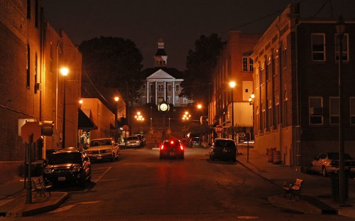
Looking toward the Courthouse

Even through I never went looking to shoot a picture of the clock, it sometimes pops up as a dot in other images. Here it is in the center of a night shot I did looking west toward the Common Pleas Courthouse.

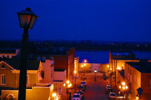
Looking toward Mississippi River

Then, it showed up in a photo I took FROM the Common Pleas Courthouse looking east down Themis.

Maybe the next generations of Cape Girardeans will appreciate it more since it was part of their childhood. Or, will there be any of that generation who ever made it downtown to SEE the clock during their childhood?