Murtaugh Park in Historical Triangle

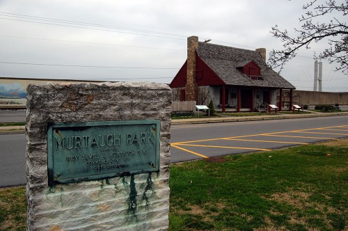
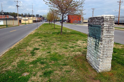
I parked the car on Main Street near the Red House to walk across to photograph the Synagogue and St. Vincent’s Church. As I was crossing the median, I almost bumped into a stone monument with a corroded plaque attached to it.

MURTAUGH PARK

Named for Rev. James A. Murtaugh C.M.

Commemorating His

Civic Efforts

Time goes by after public buildings, streets, parks and bridges are named after someone special and our memories fade or the name becomes just a name, not a memorial. I often say that you live only so long as someone remembers you.

Who was James A. Murtaugh?

And, why did he deserve a skinny sliver of a park? A Google search turns up pretty empty. He was assistant pastor of St. Vincent’s Church (which is visible in this photo) and President of St. Vincent’s College.
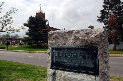
He was known for being active in civic affairs and doing much to reduce friction between the city’s Catholic and Protestants. An Oct. 2, 1934, Missourian article said, “By his activity, he removed all imaginary lines between Catholics and Protestants and developed a united community.”

He was an early proponent of paving streets and roads. Paving Main Street had the side advantage, I read somewhere, that parishioners could now use the front door of the church without tracking mud inside.

Rev. Murtaugh died in 1916. The Knights of Columbus dedicated the memorial marker Oct. 14, 1928.

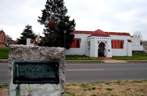
Synagogue, Catholic church and Red House

Murtaugh Park is in a perfect historical triangle between the Catholic Church, the Jewish Synagogue and the restoration of Lorimier’s Red House.

In 1958, The Missourian editorialized against a plan to remove the park to create more parking along Main St. The tiny park also memorialized Police Chief N.J. (Jeff) Hutson, who was shot and killed in the line of duty Oct. 7, 1922. The Lion’s Club planted a hawthorn tree in his honor on Arbor Day in 1923.

No big Hawthorne trees

I don’t see any large hawthorn trees north of the Murtaugh monument.

It must have gone the way of a the large, spreading hawthorne tree, “one of the finest specimen of its kind to be found anywhere,” that was planted by the Wednesday Club on April 11, 1923, to honor Miss Amy Husband Kimmel, who founded the club in 1902.

A Southeast Missourian story July 7, 1956, headlined Amy Kimmel Hawthorn, Long Pride of the Community, Is Ruined.

The story goes on to say, “During construction of the new flood control sewer, the east half of the tree was cut or torn away as if some giant knife blade had descended on it, leaving only the west section intact…. For many years it has been one of the show trees of the community. Now, butchered and distorted out of shape, it’s ultimate future is in doubt. At the time of the ceremony, an appropriately inscribed stone was buried beneath the tree. What has become of it?”

Kimmel marker found, relocated

A Missourian follow-up on Oct. 16, 1956, said the stone marker had been found and was going to be moved to a parkway east of the divide between Academic Hall and Kent Library. The Main St. parkway where the tree and marker had been located was paved over after the Kimmel Hawthorn was destroyed.

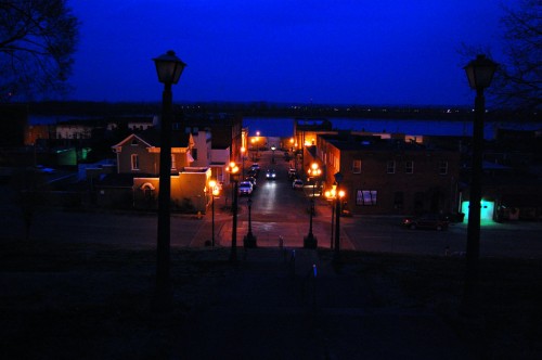
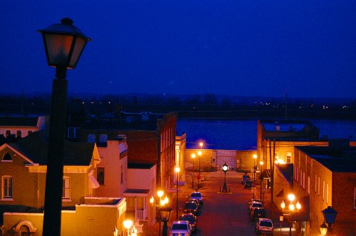
Nighttime Old Town Cape from the Common Pleas Courthouse

I have a favorite night shot of the Common Pleas Courthouse and Port Cape Girardeau taken from the Themis St. floodgate looking west, so I thought I’d see what it looked like from the other side.

This is shooting down the courthouse hill looking east down Themis St. The floodgate at the end of the street is closed because the Mississippi River is at about 36 feet.

Loose shot or tight shot?

I couldn’t decide whether or not I liked it as a wideangle or a slightly tighter photo. Electrons are cheap, so you get both.

There are some tiny smudges in the tight shot in the middle of the sky. You can calls them puffs of smoke if you like, but I think they are specular highlights from the street lights bouncing around between the lens elements. What the heck, let’s go back to calling them puffs of smoke. That sounds more interesting.

Bill Emerson Memorial Bridge from the Courthouse

While putzing around trying to get this shot composed, (for the record, I don’t care much for it) a young woman materialized from the shadows. We exchanged some pleasantries and she disappeared. There was an elderly gentleman sitting on a park bench nearby and he said, “Do you reckon we scared her off?”

Shana Gemoules, stairclimber supreme

About five minutes later, she showed up again.

“Did you just run up those courthouse stairs? Twice? On purpose?”

“Yes. It was three times.Yes. I’m training for a triathlon in Florida in April.”

When she disappeared down the hill again, the man on the park bench said, “Tell her there are 55 steps, not counting the landings.”

When she got back to the top, she was barely breathing hard and her heart rate was in the low 170s (resting is usually 52 BPM, she said.) A stint of working in a downtown restaurant where she had to hump meals up three floors prepared her for running up and down the courthouse steps, she said.

Getting ready to go car-free

Shana, who grew up in Perryville, graduated from Southeast Missouri State University and has worked at a variety of local resturaunts. She’s at Imo’s Pizza now, a place she rates highly for its employee-friendly management and good food.

Right now, she’s working to get debt-free and to sell her car to cut expenses. Cape is small enough that she feels like she can get around on foot or or her bike. Her boyfriend lives in a house with three other guys. The four of them make do with one car for those times when they go a long distance or need to carry something bulky.

When she finished her fifth climb up the hill, she said she was going to call it a night. All of the talk about food and restaurants had made her hungry.

I waited until she had run out of sight before I headed to my car. I wasn’t going to insult her or embarrass me by offering her a ride.

Mississippi River on the Rise

When you grow up in a Mississippi River town like Cape Girardeau, you learn to rattle off flood stages and historical floods like other kids can name cars as they drive by.

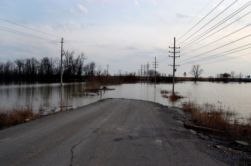
This is Old Highway 61 just south of Cape. Before Interstate 55 was built, this was the main road to Memphis and New Orleans to the south and St. Louis and Chicago to the north.

July 5, 1947, the river hit 41.88 feet, its third highest stage in history up to that point. Highway 61 and Highway 25 went under water, halting car, bus and truck traffic north and south except by taking a circuitous route.

This flooded stretch of Old Highway 61 reaches a dead end at the Diversion Channel. The waters are an inconvenience only to fishermen who would normally launch their boats at a ramp at the end of the road. The Diversion Channel is a drainage ditch that was greatly responsible for changing Swampeast Missouri into valuable farm land. When the Mississippi is high, the river backs up the channel, flooding homes and acres and acres of crops.

1947 was a piker

Time goes by so quickly. It seems like we’ve just had one 500-year flood when another one comes right along. These days, the 1947 flood barely beats a 2008 flood to hang on to ninth place.

Here are the top five crests

  1. 48.49 ft on 08/08/1993
  2. 47.00 ft on 05/24/1995
  3. 46.90 ft on 08/03/1993
  4. 45.70 ft on 05/18/2002
  5. 45.50 ft on 05/01/1973

Those numbers have special significance for the Steinhoff family. We have property in Dutchtown that goes under water when the Cape river gauge reads 39 feet. Want to see what 48.49 feet, give or take, looks like when you get wet at 39?

Inside the mechanic shed in 1993

Before my Dad got out of the construction business, this was a large shed used for carpentry and heavy equipment repair. We never dreamed that the water would come up so high and so fast, so we lost some shop equipment and a heavy-duty air compressor. Flooding has become so common that everything of value has been placed high enough that we hope it’ll stay dry for the next 500-year flood.

My brother Mark looks a little uncomfortable because I pointed out to him that flooding brings out snakes, who are looking for higher ground. “We sure look like higher ground to me,” I said.

Why are there more floods?

Man has tried to control the river. It’s been dammed, channelized and confined to a narrower and narrower path than in the days when it could spread out over miles of flood plain. When water can’t spread out, it has no choice but to go up.

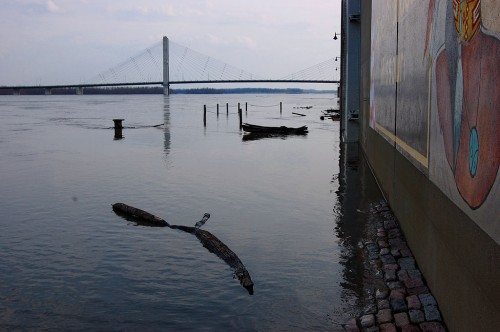
Water’s already lapping at the base of the floodwall at the Themis St. flood gates. When the river gets a couple feet higher, the Broadway gates will close an the city will be sealed off.

Storytelling on the riverfront

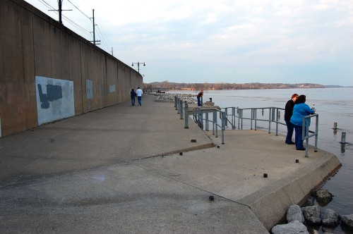
A steady stream of visitors come down to watch the muddy waters swirl by every day, but their numbers swell when the river’s on the rise.

I overheard a couple of women wonder what a hole in the wharf was for. (It’s a pipe that would normally have a handrail attached to it, but it had been removed, probably to keep from catching debris.)

I couldn’t help but tell them “that’s where you put in a quarter to keep the river flowing. It’s coin operated. There are locks up the river that open up when the meter is fed. You were lucky to come along after someone else dropped a coin in the slot. It’ll turn off any minute.”

“Really?” one of them asked.

By the way, if that kind of fibbing appeals to you, you should show up for the Storytelling Festival April 9-11. It ain’t lying if you call it storytelling. And can keep a straight face.

Map showing Old U.S. 61 & Dutchtown


View Old U.S. 61 and Dutchtown in a larger map

Cape Bridge at Night

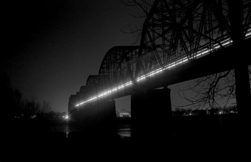
When I didn’t know what else to do, I’d head down to the river to try for a different shot of the bridge. This is a time exposure taken from the Illinois side looking back toward Cape.

The car and truck lights show up as streaks.

Trust me, this will NOT be the last bridge picture you see.