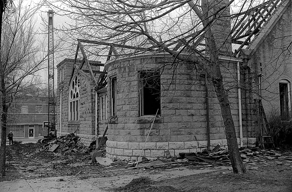
I captured the final days of the First Presbyterian Church located at the corner of Broadway and Lorimier, across from The Southeast Missourian, in March of 1965. The building was 63 years old.
When I look photos of landmark buildings torn down in those days, I’m amazed at how little was salvaged. The 110-year-old bell that had called out firefighters and warned of jail breaks was saved to be reinstalled in the new church, but beautiful ornate woodwork was knocked down and hauled off.
Cornerstone was removed
 A March 30, 1965, Missourian story said that the building’s cornerstone was removed and would be examined later by a church committee comprised of Jack L. Oliver, Allen L. Oliver, Wendell P. Black, Mrs. Clyde A. McDonald and Mrs. Robert L. Beckman.
Bell goes back home
 Before the end of the year, the new church far enough along that the bell could be reinstalled.
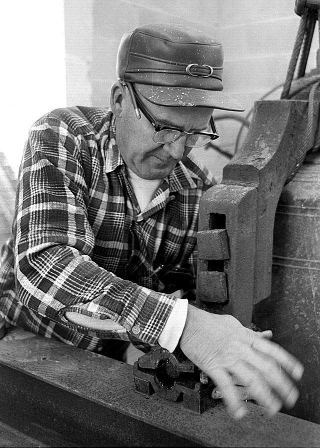
The re-belling didn’t go smoothly
 The Dec. 1, 1965, Missourian story chronicled a number of missteps before the bell was placed gently into its cradle.
- It had to be moved to a spot directly in front of the church.
- The boom on the crane had to be lengthened.
- A parking meter was in the way and had to be removed.
- The crane ran out of gas and someone had to be dispatched to bring back five gallons to crank it up.
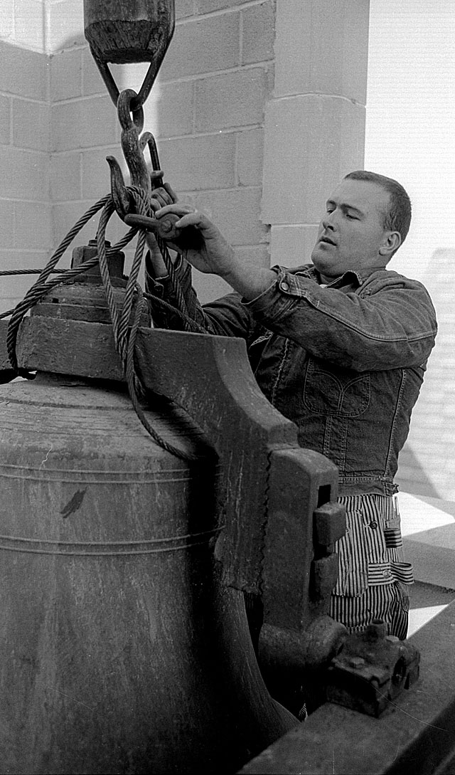
Finally it was on its way up
 The Missourian building is on the left. The Idan-Ha Hotel hadn’t burned yet, and the city was still using the silver star Christmas decorations. Anybody know when those were phased out and what happened to them? I always thought they were kind of classy looking.
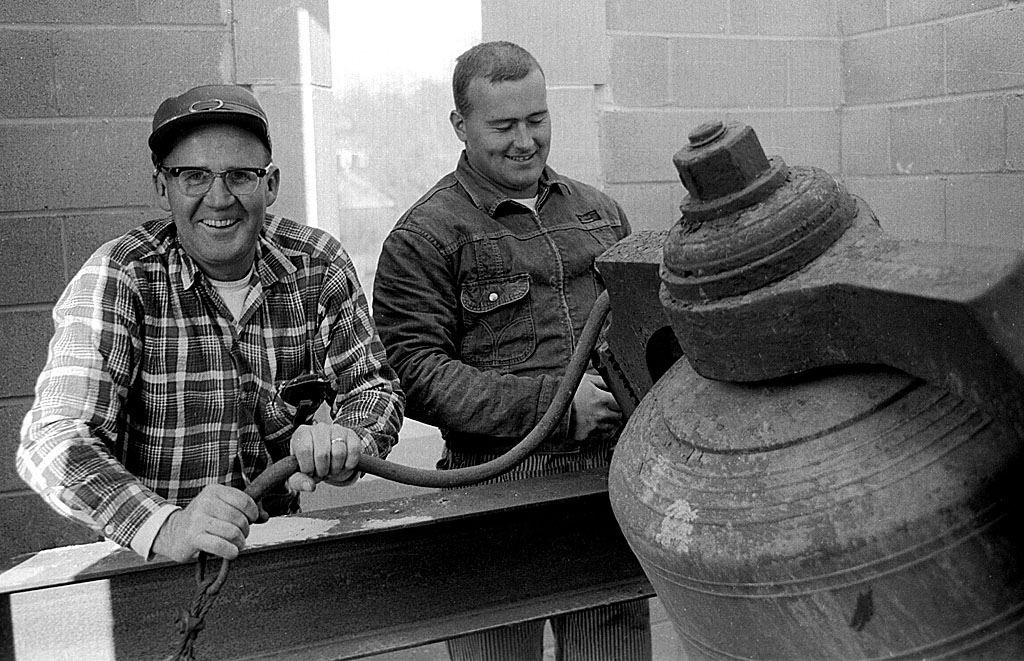
Pete Gibbar and Bill Vopelker were waiting
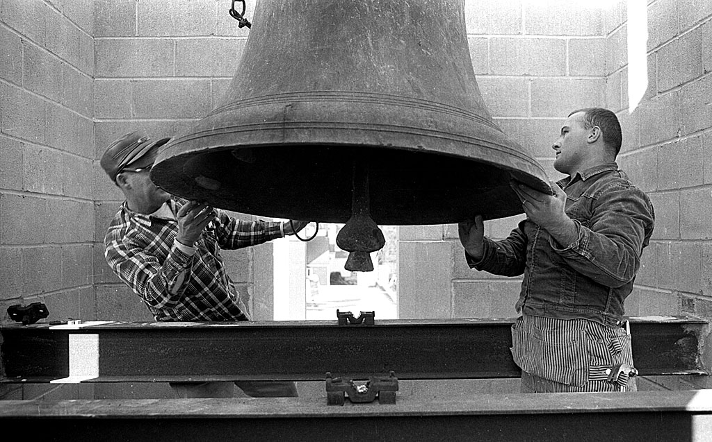
 Pete Gibbar and Bill Vopelker, both of Perryville, were in the bell tower waiting for it to be lowered into place.
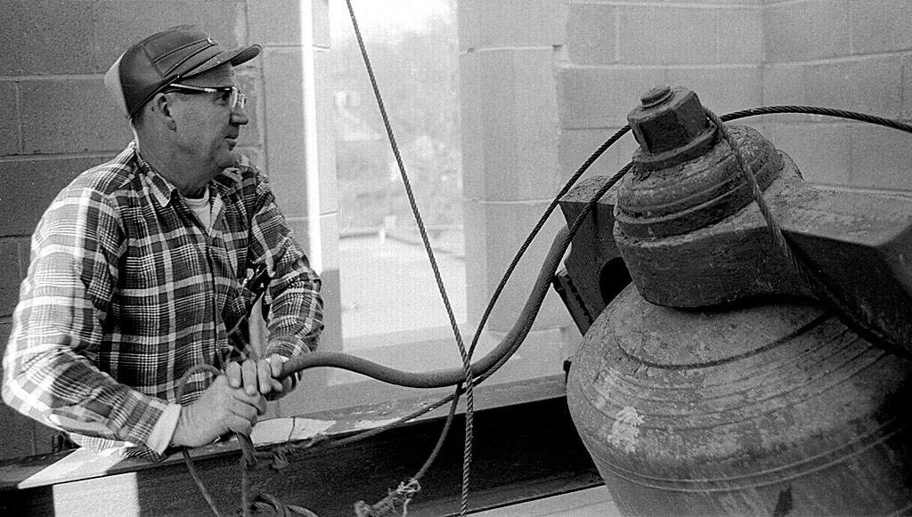
Bell bolted into place
 The bell landed right where it was supposed to and was quickly bolted into its collar.
It works!
 Pete and Bill were clearly happy when they rang the bell for the first time in its new home, the third of its existence. It was originally mounted in a wooden tower located on the courthouse side of the original brick Presbyterian Church. The tower and the church were torn down in 1904 to build the church that was just razed.
The bell, which is inscribed, Jones & Hitchcock, founders, Troy, N,Y, 1855,” was originally cast for a St. Louis church, but it proved too heavy to be used there. Mrs. Addie McNeely bought the bell for First Presbyterian for $500. It’s 43-1/2 inches wide at the mouth and weighs about 1,400 pounds.
First Presbyterian Church Photo gallery
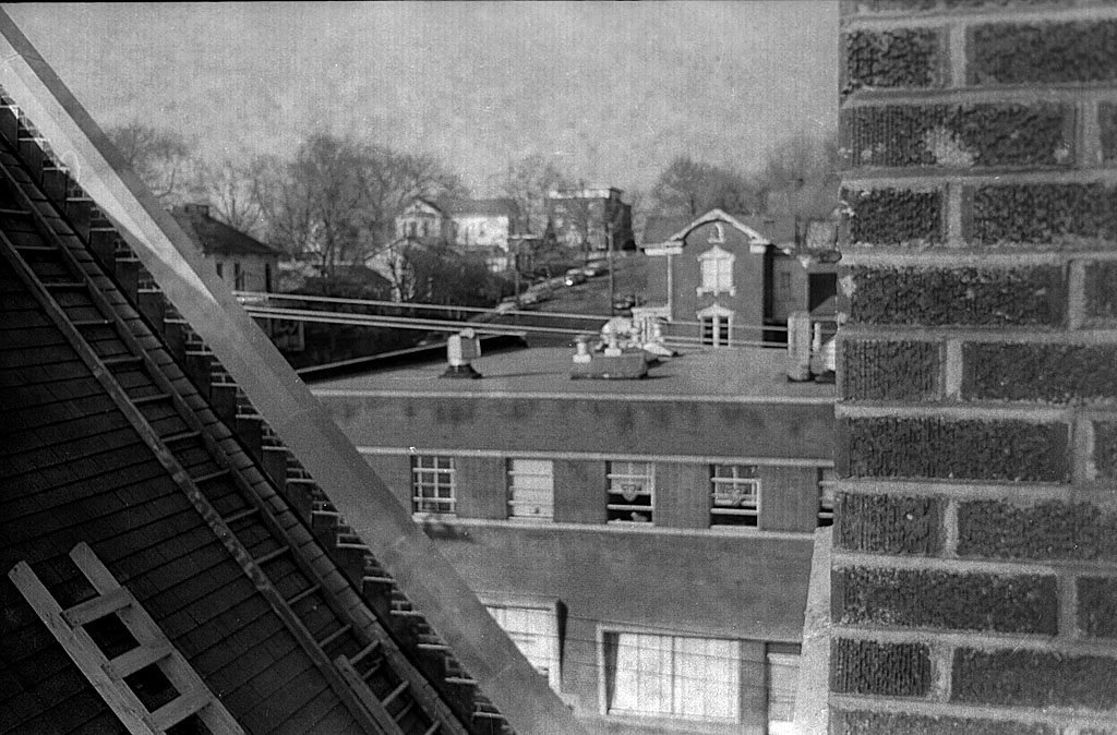
Here is a gallery of other photos, including a strange shot I took while changing film on my way up to the bell tower. I include it because it shows some of the buildings in the area. Click on any image to make it larger, then click on the left or right side to step through the gallery.

 I don’t know who these boys are, but the place has the feel of Cedar Lake to it. I see a fence on the left that’s going off into the water. I vaguely remember something like that from the half-dozen or so times I went to the lake. The boy on the right has on a Boy Scout T-shirt, but I don’t recall ever going out there with Troop 8.