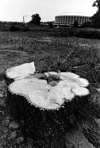
 This was the “after” photo of one of my favorite pictures. You can see the “before” photo on my 2010 Earth Day page. It was taken in Athens, Ohio, but there will be plenty of opportunities to duplicate it along Bloomfield Road in the coming months.
150 trees to die
I haven’t heard from any of my readers who attended the meeting yet, but The Missourian had a Scott Moyers story about the Bloomfield Road public hearing posted before I went to bed.
City Engineer Kelly Green said the city has taken measures to minimize the loss of trees, but that some would have to come down to widen the road from 22 to 28 feet. “Some” is as many as 150.
Bottom line: the project will start in June and dozens of trees have already been marked for removal.
All about safety, city says
City officials, Moyers wrote, say widening Bloomfield is crucial for making safer a road that is the site of several accidents a year and even a occasional road fatality.
I didn’t do an exhaustive search, but I put “Bloomfield Road” into The Missourian’s search box. Not a single accident popped up. There were plenty of Police Reports listing people who LIVED on Bloomfield Road who had been picked up for driving drunk or stealing things, but no accidents.
How does it compare to other roads?
 I’m sure there are some. What I’d like to see is how Bloomfield Road’s accident rate compares to other streets with similar traffic volumes. What makes Bloomfield Road “crucial?”
I’m going to bet that if I HAD turned up accident reports, they wouldn’t have been “accidents.” I bet they would have been “crashes,” attributable to speeding or unsafe driving, things that can be prevented by law enforcement, not road widening. All road widening will do will be to increase speeds and traffic volume.
Roundabouts and other traffic calming devices constrict traffic to slow it down. Isn’t that what Bloomfield Road does naturally?
What do we do now?
It’s too late to save the section from the city to Benton Rd. That train has left the station.
Project Manager David Whitaker said that the next phase, which will take out what I think is the prettiest section – from Benton Road to White Oaks Lane – is starting with the concept that is similar to the work this summer, but that input from Thursday’s meeting could change the nature of the work in 2013.
Engineer Green said that nothing was set in stone for the next phase and they would compile the input from Thursday night’s meeting.
Here’s your civics class homework assignment
There’s your homework assignment: stay on top of the next phase. Make sure your input is “compiled” and not composted.
I’ll try to keep on eye on it, but I’m 1,100 miles away. You are the folks who live there and will have to show up for meetings.
Other road “improvement” stories
Mount Tabor Park at most scenic crossroad site in area
Mount Auburn Road started as a scenic drive

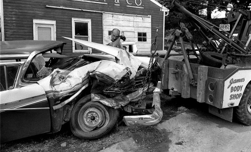
The wrecked car and James wrecker was taken on Big Bend road ( Hwy 177 ) near Timon Way.
Guilty. I wanted something to break up the copy, so I reached out for a generic wreck shot because I don’t remember ever working a crash on Bloomfield Rd.
We certainly have lost most of it but not all of it.
Other than the beauty of the road and the killing of trees there are other resons to leave the road alone and they are future flooding due to inadiquate drainage and thus closing the road to traffic, as well as the maintanance and the patrolling of the road for speeders. They can’t do it now because the road is too narrow, the proposed road won’t let them do it either.
The city can’t keep up with maintanance on the streets they have. Bloomfield Road will certainly fall to the bottom of that list.
Please express your concerns to the city engineers office or the city council. We need your help!!!!!
Bloomfield Road is under Cape Special Road District. They will provide all maintenance (including snow removal). They maintain but their budget does not allow building new roads.
Here’s an email I received this morning from Jenette Juden, who attended the meeting:
Hi Ken,
It was a travesty.
Maps were laid out on tables and people from the city engineers office were there to explain them to us mere mortals.Papers were provided for us to put down our names, addresses etc. and our opinions on the project.
Supposedly these will be reviewed (probably by someone living in a trash can) and considered for their value in planning our portion of the project.
Also on this table, which was also a sign in table, was a pile of small sheets of paper headed TRAFFIC CONTROL FOR BLOOMFIELD ROAD PHASE 4 PROJECT. This paper says starting Wednesday, June 1, 2011, until the end of the project (possibly January 2012) Bloomfield Road just south of Stonebridge Drive to just north of Benton Hill Road intersection WILL BE CLOSED TO THROUGH TRAFFIC. Benton Hill/Bloomfield intersection will remain open
Beginning approximately med-July 2011 for no more than 60 days the Bloomfield Road/Benton Hill Road intersection WILL BE CLOSED TO ALL TRAFFIC.
The only representative from the city council was the mayor who showed up after 7. The meet was from 6:30 to 8. Figured he was arriving late and leaving early.
There were several people there who were opposed to the project, our end of it. There were some couples who were on each side of the fence and there was one lady there who didn’t live out here but was violently opposed to it.
I talked to the project manager which, by the way is the assistant city engineer, I asked him about just fixing the known problem curve in the road or better still put up some stop signs and some street lighting. He said he had NEVER heard of fixing just a portion of a road. Now that made me wonder where he got his engineering degree.
As for the simple fix of stop signs, which we all know slows down traffic, he had no answer. Better to spend millions than just a few thousand.
We also asked him about how they were going to deal with drainage. Not a satisfactory answer there either. In fact I don’t think the man gave me an intelligent answer to anything except saying that the plans weren’t drawn yet so he really couldn’t answer a few other questions I had, except street lights were not in the plans.
Now for your good part——there is a hiking/biking trail. It is offset from the road with a small green space between so more trees will be cut for your trail and more runoff will have to be dealt with from that. I do not know for sure as I didn’t ask but it looked like the trail was about 4 feet wide, possibly more but not by much.
Now for the bad news about the trail, it will have to cross Bloomfield Road, which will be 28 feet wide, at some point between Earl Norman’s property and ours. It will be on the East side of the road and then cross to the west. How it will tie into any other trails is a mystery to me and what they plan to do where it ends is also in the mystery category.
There will be more meetings, I was told, on Phase 5 before the final plans are drawn up.
Disheartened but still vaguely hopeful,
Jeanette
you were right yesterday, cape has to spend moneym on something, and bloomfield road was up for a unneeded repair. Since i do not live in Cape any more, not much I can do or protestabout.
Well, Ken, it appears we have another member of the CHS Class of ’65 to thank for the funding of this and similar projects, and he’s proud of it. See http://www.semissourian.com/story/1728492.html
Apparently the Bloomfield Road improvements fall into the desperate category.
Growing up in Cape, we, like many others, had no air conditioning so, on the hottest days of summer, Mom would take us kids for a ride down Bloomfield Road with all the windows down. THAT was our air conditioning in the 50’s. I can still remember how cold the air felt on that stretch of road, with the trees completely covering us overhead. And even today the smell of the woods still takes me back to that time in my memory when I happen to catch the fragrance anywhere in my travels. Sad that the old Bloomfield Road will only exist in our memories before long.