 Happy Hollow was one of those places like Smelterville where everyone knew there were problems, but solutions always seemed to escape. When the Lorimier School Parent-Teachers Unit complained in 1952 about open sewage flowing through the hollow near the school, creating a health hazard for the children, one councilman mentioned the possibility of erecting a fence around it.
Mrs. Lloyd Brooks, chairman of the Lorimier committee, countered, “I don’t know of any city that has a hole like that in the middle of town – and then thinks enough of the hole to fence it in.” (Click on the photos to make them larger.)
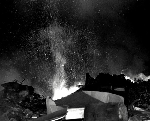
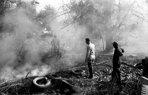
1966 Happy Hollow fire
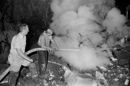 The Missourian’s September 16,1966 photo caption said “Happy Hollow burst into a sudden inferno Thursday night, spewing fire and sparks and sending up a choking cloud of smoke to the southeast, limiting visibility and damaging residences. Two firefighters, Victor L. Pierce, left, and Capt. Charles Benton, drenched by water and perspiration, pour a stream of water into the billowing clouds of smoke.”
Fire could smolder through winter
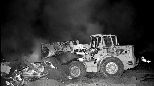 The story continued, “Flames were brought under control Thursday night. However Fire Chief Carl Lewis said a fire of this nature is extremely hard to eliminate. He explained that smoldering is now beneath the surface of the dump and could continue for an extended period, possibly through the winter.”
Smoke nearly choked her
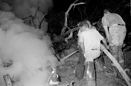 Mrs. F.M. White, who lives near the site of the fire at 512 rear William, said the smoke nearly choked her and her husband to death.
Firemen fought the flames through the night and were continuing the attempt to conquer the smoldering mass today. At one time, there were 11 firemen at the scene. Chief Lewis said the fire was the largest of this nature in more than 20 years.
Similar fire in 1934
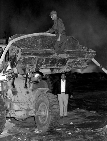 The June 16, 1934, Missourian reported, “A fire which converted “Happy Hollow” and its rubbish heaps into a roaring furnace shortly after noon today was brought under control by firemen after a two-hour battle. No damage except to trees was done, as firemen worked in 100-degree temperatures to extinguish the blaze.
“The blaze started about 12:15 o’clock of undetermined origin and smoke and fumes filled the Happy Hollow ravine, which is located east of Frederick Street between Merriwether and William streets. Scores of automobile bodies, tons of paper, old clothes, boxes, barrels and other junk went up in the blaze. The fire department’s big pumper forced water from a hose line attached to a hydrant at William and Frederick streets, and the stench from the smoldering rubbish drove a curious crowd to cover.
“Firemen were aided by volunteers who helped turn the rubbish heaps so that water could penetrate them. The main part of the blaze was confined to a pile of rubbish about 25 feet deep. The place has long been used as a city dumping ground.”
Happy Hollow Cave
 The area was full of attractive nuisances. The January 18, 1952, Missourian talked about the Happy Hollow Cave: City Engineer John Walther said today the city would be interested in razing and closing Happy Hollow Cave in exchange for the sandstone blocks of which the cavern is constructed.
The Missouri Pacific Railroad probably owns the cave, which is located in Happy Hollow, south of the railroad’s freight yards on Independence Street. Lorimier School is near the yards. The Lorimier School Parent-Teacher-Unit says the cave attracts children and is an unsuitable place for them to play.
The cave was built nearly 100 years ago as a cooling cellar for the old Hanney Brewery, but was abandoned decades ago. Since then it has become a hangout for vagrants, drunkards and other characters well-known to the police.”
Cavern not easy to raze
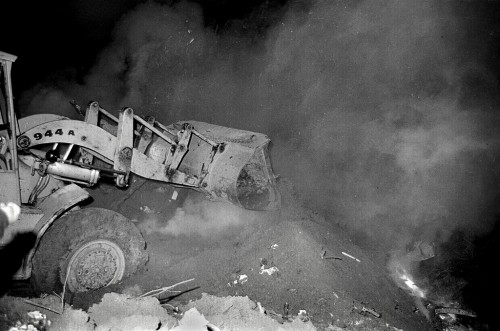 May 2, 1952: “A dragline crew today was destroying Happy Hollow Cave, the man-made cavern police called a hangout for vagrants and thieves, and parents called a menace to children.
The first, or east compartment of the cavern was dug up and filled Thursday and today the crew was working on the second compartment, which reaches under the Cape Coal Co. yard. Some difficulty is being encountered. The highest point of the arched ceiling is some 30 feet below the surface of the ground… And the sandstone block ceiling of the cave does not yield easily to the steel teeth of the bucket. Neither do the brick-lined wall of the connecting passageways.
The plan is to remove all the dirt from the top of the vaults, pull out all of the curved ceiling, then fill in the hole, leaving the vertical walls standing.”
Rats! Guess who got THIS assignment
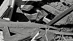 When the job called for writing about the sewage treatment plant, getting up on a cold morning for a quarry rescue or going to the dump to count rats, I was the guy. On one of those Friday night bull sessions over at Arlene Southern’s house, we were griping about our jobs, like workers always do. When the discussion came around to me, I said, “They ought to hire some high school kid to write the obits and briefs and that kind of junk to free us up for the important stories.” When I looked around the table, everybody was grinning at me. That’s when I realized that’s exactly what jBlue had done – I WAS that kid.
The Missourian was pretty strict about not inserting yourself into a story, but I was given some latitude in this unbylined piece on September 26, 1966. The Google copy was pretty blurry, so I couldn’t grab it all.
“Superior brand of chiggers”
“A Missourian reporter spending a couple of hours with a camera at Happy Hollow Saturday afternoon found that the no-dumping signs placed at the former city dump have had very little effect.
He also found that the Happy Hollow is evidently the happy home of uncounted hundreds of rats. The rat in the photo wasn’t alone. By actual count, it had at least five others in the same pile of trash. Farm statistics of rat populations, quoted by the Missouri Extension Office at Jackson, show that for every rat sighted there are 50 others nearby.
The reporter’s notes added, ‘In addition to rats, garbage and mud – which comes from either sewer or seep water – Happy Hollow also breeds a superior brand of chiggers.'”
Happy Hollow is cleaned up
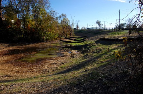 After decades of discussion, most of Happy Hollow has been filled in and cleaned up, at least the area from William Street to River Campus. This view is looking north from William on November 9, 2010.
South Fountain extension
 This is South Fountain looking north toward William Street.
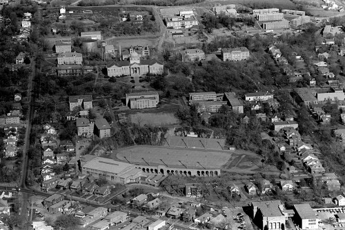
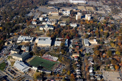
Aerial view of the area
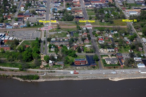 This is the aerial I ran yesterday with the Houck Railroad bridges story.
Speaking of which, I posed the question, “I wonder if ghost whistles of Louis Houck’s engines can still be heard in the neighborhood at night. I’m sure reader Keith Robinson will tell us much more about the railroad.”
Keith outdid himself with this one.
Ghost whistles in the night
The area of Happy Hollow might well hear ghost whistles in the night.
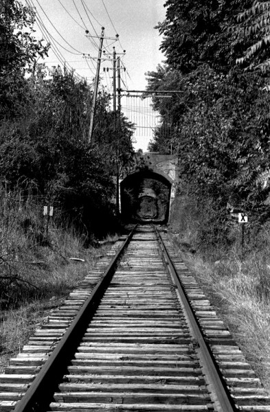
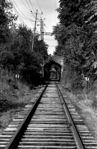 Just south of the Morgan Oak viaduct, was the location of the untimely death of my great-great grandfather, Jesse Robinson in 1901 when my great grandfather, Goley Robinson was working for Houck’s Southern Missouri & Arkansas Railroad. The SM&A was the progenitor of all the tracks in downtown Cape and to the south.
According to the Coroner’s Inquest Report, Jesse was apparently run over by an SM&A train backing down the tracks when a double-bit crosscut saw that he was carrying over his shoulder caught the back end of one of the cars. He was 56 years old and my great grandfather was 19. As result, the Robinson family ended up in a house on the Louis Houck estate until the family could get on their feet.
Goley and his younger brother, Ivan, were locomotive firemen on a number of Houck’s railroads until they finally became part of the Frisco and Missouri Pacific. My great grandfather stated that he would sound a wavering whistle every time he passed over the spot where his father died.

