Preservation Homework: Churches & Cemeteries

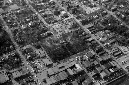
Aerial Common Pleas Courthouse 04-14-1964Dr. Katy Beebe invited me to speak to her historical preservation class at Southeast Missouri State University last year. Dr. Lily Santora asked if I would come back April 8 to meet with her class.

Dr. Beebe’s class was researching Main Street, so I put together a list of the stories I had done about downtown. Dr. Santora gave her class a wide variety of local landmarks. I’ll spend the next couple of days helping her students by posting links to stories I’ve done about their topics. I’m going to concentrate on churches and cemeteries today. (Maybe I can make up for all those assignments I didn’t turn in when I was a student.)

[Hint to students: don’t just read what I’ve written. The comments are generally more interesting than my copy. Feel free to post questions and comments of your own. My readers are a friendly group who love to share Cape’s history. Click on the photos to make them larger.]

First Presbyterian Church
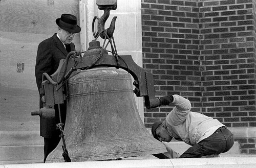
St. Mary’s Cathedral
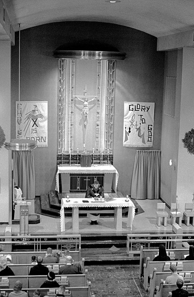
Christ Episcopal Church

Christ Episcopol Church 04-16-2011The church and May Greene Garden

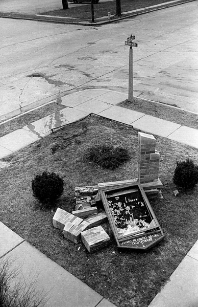
Evangelical United Church of Christ

Crash knocks over sign in front of Evangelical United Church of Christ c 1966Crash damages church sign

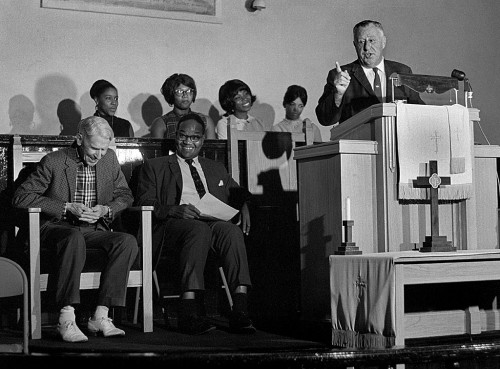
 St. James AME Church

NAACP 08-10-1967National NAACP president speaks at church

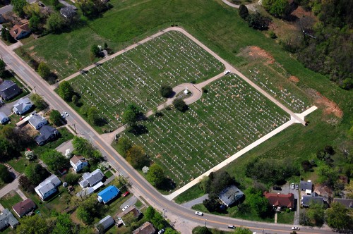
Fairmount Cemetery

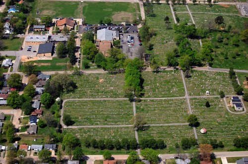
 St. Mary’s Cemetery

St. Mary's Cemetery 04-17-2011_5233Aerial of St. Mary’s Cemetery


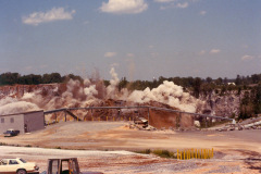
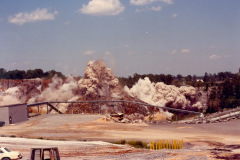
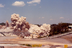
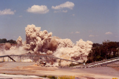
A Blast at the Quarry

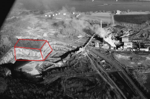
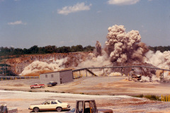
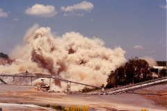
Cement Plant Quarry with blast zone marked by box c 1966After I ran photos of the cement plant quarry yesterday, reader Keith Robinson sent me this sequence of photos of the caverns being blasted. He annotated my1966 aerial to show where the blast was centered.

You can see to the right of the “box” the narrow wall that divided the “Blue Hole” from the main quarry. Keith said family friend Burl Medlock made it possible for him to take the photos.

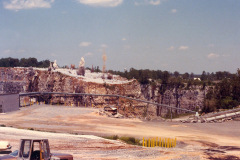
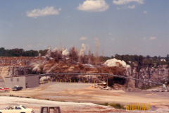
He said the blast used 300 tons of explosives and loosened 1.5 million tons of rock. The surface area was estimated at 6 acres and was up to 200 feet deep. Here’s The Missourian’s version of the blast.

Keith’s photo gallery of the explosion

Click on any photo to make it larger, then use your arrow keys to move through the gallery.

Serpentine Suggestions?

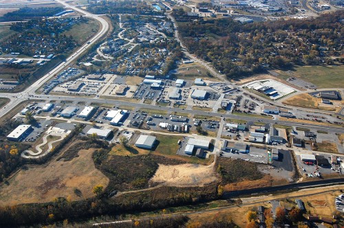
AerialSouthern Parkway - S Kingshighway 11-06-2010_9075I was scrolling through aerial photos from November 11,2010, when an unusual shape caught my eye. It was in just one frame, and I couldn’t place what or where it was. (Click on the photo to make it larger.)

I called up Google Earth and worked my way along I-55 looking for the serpentine-shaped pavement at the lower left. After determining that the four-lane divided highway wasn’t the Interstate, I figured out that north-south road was South Kingshighway and the major road running east and west and intersecting with it is the Southern Parkway.

Running across the bottom of the photo is the Cape Recreational Trail paralleling Cape LaCroix Creek.

I was confused, though, because something as oddly shaped as my target should pop right out. By looking at the other landmarks in the area, I determined that the building was located on the south side of Commercial Street where it deadends at South Kingshighway. The reason I couldn’t find it is that it’s been wiped out.

I shot my photo in 2010. Google Earth showed it there in 2011, but when they make their last pass on April 1, 2012, the land was in the process of being cleared. Google Earth has a cool timeline slider that will let you step back through all their photos. The track hadn’t been built when they flew over it on on March 26, 1993, but it did appear on March 21, 1996.

So, what WAS it, a go kart track?


Northbound Towboats

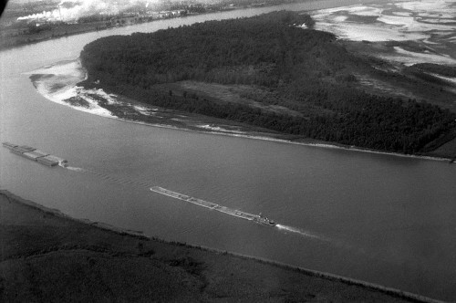
Mississipi River BargesThese northbound towboats pushing a string of barges were off Marquette Island south of Cape Girardeau when I shot them sometime around 1964. The white smoke at the top left is from the cement plant.

Click on the photo to make it larger.

Like running in molasses

I’m still recovering from the data drive that went south. The backup restoration has been running for more than 24 hours and has recovered all but about 10,000 files out of 487,776. It’s still churning away, but because the rebuild is taking 99% of the CPU cycles, memory and disk access, everything else is running like that nightmare I have from time time time: the one where the bad guys are chasing me, but I’m running like I’m in a swimming pool full of molasses. I think I’d prefer that to a slow, non-responsive computer.

I hope things will be back to normal by Tuesday morning.