Taming Swampeast Missouri

Keith Lewis had a story in The Missourian October 4 noting that work on the Little River Drainage District started 100 years ago. There was a good reason why old-timers refer to this area as Swampeast Missouri: a large portion of Southeast Missouri was nothing but nearly impenetrable swamps with names like the Dark Cypress, Old Field and Big Field.

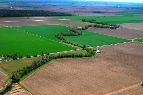
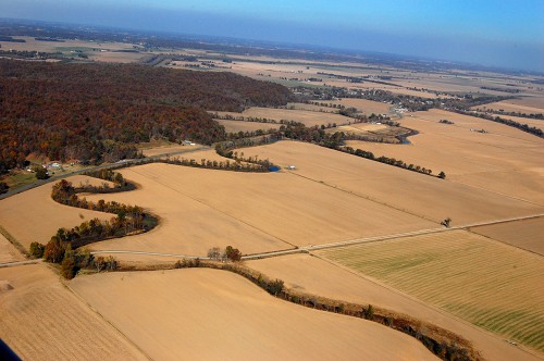
This aerial photo was taken south and west of Delta and shows the old Whitewater River meandering through what once would have been swamp. Dad had a job to divert the river, essentially cutting off this channel years and years ago.

Miles and miles of farmland

Once the timber was logged off and the land cleared, it turned out to be incredibly rich for farming.

Cut trees when swamp froze over

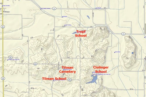
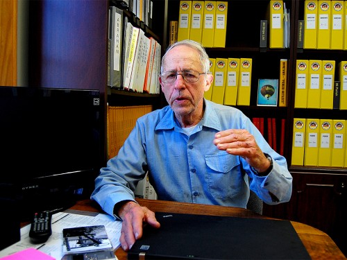
I interviewed Wife Lila’s Uncle Ray Seyer a couple of years ago when he was 89. Ray remembers growing up in the Tillman community area and hearing stories from his dad about the old days. “Pop would ride a horse – no cars in those days – from Kelso down through Delta and most of the time the water was up to the horse’s belly.”

“When they started clearing that ground there – it was all wooded area – they couldn’t cut when that water was in there.. they’d wait until it froze over, then cut it above the ice and let it float out later.”

Soft ground could swallow a tractor

Ray told some stories I had heard from old-timers back when I was a kid. I’m hoping I can run across a tape recording I made of one of Mother’s friends describing putting 12″ x 12″ “mudshoes” on horses to keep them from sinking into the “sinky” muck.

Ray and Dad both said you’d better not stop once you started across the old swamp. Ray talked about a couple of guys who used to haul limestone out of there. Their Caterpillar-type tractor stalled out at the end of the workday and wouldn’t start. They decided to leave it until the morning. The next day, only two smokestacks were visible above the muck, he said.

Diversion Channel
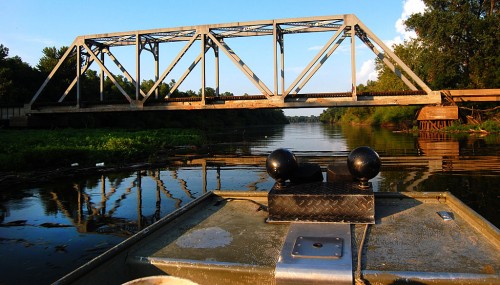
The Big Ditch is one of the main ways to move water out of the basin into the Mississippi River. Here are some of the stories I’ve done about the Diversion Channel.

Seelitz Valley

This is one of the reasons I’ve been working to document the German communities in Perry County. I showed up at the Altenburg Lutheran Heritage Center and Museum a couple of years ago with my laptop full of photos I had taken in Wittenberg and the area, including some aerials of places I couldn’t identify.

Wilmar Degenhardt happened to be in that day and started looking over my shoulder. Here’s his reaction when he spotted the Seeltiz home he was born in and where he lived until he left for the Navy during World War II.

Video of Seelitz

This will be part of my presentation in October.


Wreck at Broadway – Perry

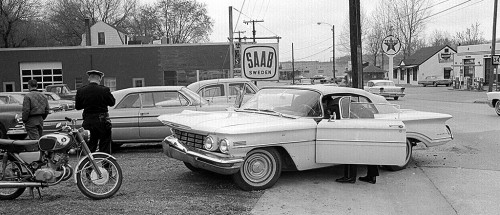
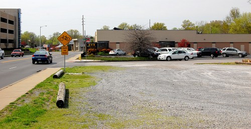
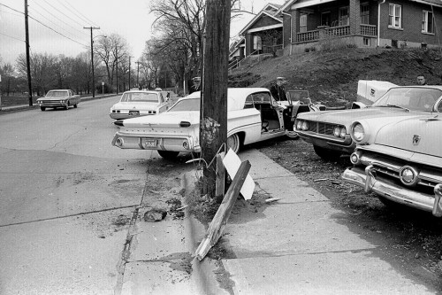
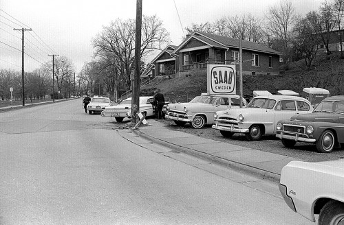
The thing that caught my eye about these photos wasn’t the wreck – it looks pretty minor. It was the neighborhood in the vicinity of Broadway and Perry Ave. and how it has changed since these photos were taken in the mid-1960s. Almost everything on the south side of Broadway has been gobbled up by Southeast Hospital. Click on the photos to make them larger.

Stubb’s Beer Garden gone

The 1968 City Directory lists the following businesses in this block of Broadway

  • 1700 – Lacy’s Texaco Service
  • 1703 – Bill Wescoat’s Trailer Rental Service & Wescoat Motor Company
  • 1704 – Cape Drive-in Cleaners
  • 1720 – Stubb’s Beer Palace
  • 1736 – Child’s IGA Foodliner

The city directory might list it as Stubb’s Beer Palace, but we always referred to it as the Beer Garden. It’s a parking lot now. Child’s Foodliner is occupied by an orthodontics practice.

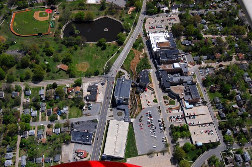
2011 Aerial of SE Hospital -1700 Block

Here is a 2011 aerial of the area. Perry Avenue comes in the from the left. Capaha Park is at top left, and Southeast Hospital takes up most of the right side of the photo. You can go here to see aerial photos of the area in 1964.

Wreck doesn’t look serious

Looks like car vs. pole and sign. I learned a long time ago not to play crash investigator and speculate about the cause of a wreck.

I may have told this story before. I had to testify in a civil suit involving a car crash. I showed up with more prints than Arlo Guthrie in Alice’s Restaurant. I was barely old enough to have a driver’s license of my own, so one of the attorneys tried to get me to speculate about the cause of the accident and to lead me into making a statement he could pounce on. I kept saying, “The photo shows x, y and z. That’s all I can tell you.”

“You testified that the skid marks were 37 feel long. Could they have been 34 or 38 feet long and not 37 feet long? What makes you so sure they were 37 feet long.”

“I took a tape measure and measured them because I figured some lawyer would ask me that.”

“No further questions.”

Houses are all gone

It’s hard to believe that the Broadway facing Capaha Park was once filled with family homes. John Hilpert, one of my best buddies in grade school lived in an old two-story house on the other side of Louisiana Avenue.


Fruitland Quarry in News Again

Fruitland’s Strack Quarry is back in the news again. I’m not even going to try to figure out what the latest wrangle is all about. I’ll let you go to Keith Lewis‘ story in The Missourian to try to figure out how a quarry that had approval to operate and which has moved a bunch of overburden and started poking a big hole in the ground can be told to put the brakes on.

When I was home last summer, I climbed a berm in on the south side of the Saxony Lutheran High School and shot a 360-degree panorama with the school behind me and a graveled area that is on the quarry property in front of me. I’ve marked the photo with compass directions to make it a little clearer. Click on the photo to make it larger.

Aerial looking north

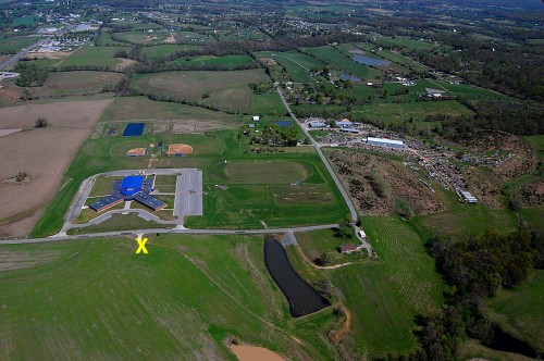
I took this aerial photo April 17, 2011. The quarry property would be at the bottom of the picture.The yellow X marks the approximate place I was standing when I took the panorama. Highway 61 is at the top left. The Y-shaped building near the center of the photo is the high school.

Google Map shows scope of work


View Larger Map
This Google Map will give you an idea of how much land has been cleared for the project. If I’m reading the latest ruling correctly, the pit itself is outside the 1,000-foot latest requirement, but the latest interpretation would require the whole operation to be 1,000 feet away, even though the north end of the property alongside CR 601 is behind a berm that is as high as the rooftop of the school.

Area quarry stories