A Plane in Every Garage

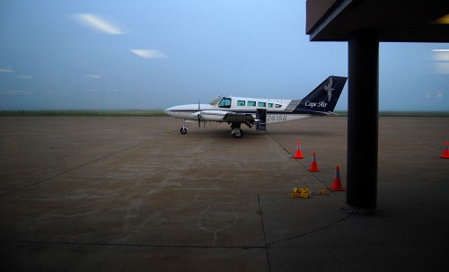
Oliver Parks predicted in 1944 that flying would become as much a part of our lives as having an automobile. So, how do you like that airplane and your neighborhood flying field? We’ll get around to that in a minute. (Click on any photo to make it larger.)

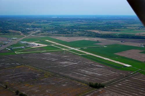
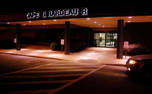
When I was looking for information on the Dollar Store, I happened to spy a June 19, 1946, story that said, in part, two Cape Girardeau men – Eddie Erlbacher and Oscar Windisch – have purchased 55 of the remaining airplanes at Harris Field [now the Cape Girardeau Regional Airport]. The purchase included the fuselage, wings and landing gear; the engines had been removed and retained by the government.

Going to salvage landing gears

Twenty-two of the planes were the AT-10 twin-engine ship used as an advanced trainer. Eight were A-25 Helldiver dive bombers. The buyers took the ships at an average cost of $35 each. The men plan to use the landing gear in making agricultural and commercial type trailers for moving livestock and farm equipment.

“There are only 111 salable ships left at the field out of the 1,200 originally there. Of this number there are 48 of the PT-23 models, 30 Timms biplanes, 14 twin engine UC-78, or twin engine models, 15 AT-17 twin engine ships and four of the dive bombers.”

One thing led to another, and I found the following story, written two years earlier. (By the way, the City of Cape Girardeau website has a brief history of Harris Field, which became the Cape Girardeau Municipal Airport.)

Future of aviation after World War II
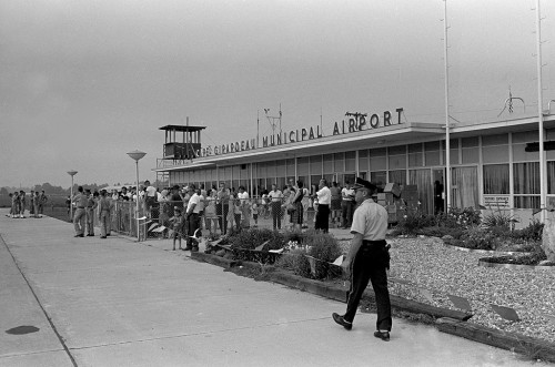
On July 6, 1944, The Missourian did a Q & A with Oliver L. Parks, head of Parks Air, which operates Harris Field [Cape Municipal Airport] and four other flying schools, who described what aviation will mean once the war is over. It’s worth reading the full story about his flying predictions. Here is a boiled-down version of the more interesting parts of the interview.

Neighborhood landing fields
Q: Would acquisition of Harris Field answer Cape’s flying needs completely?

A: No… For private flying, Cape Girardeau would want two or three small landing fields right on the edge of the residence district. Motoring is so much a part of social and business life today that our garages are a few steps from our front door; yes, in many instances, the garage is part of the home. Flying will become just as much a part of daily existence in the future. Therefore, the private flier will want his airplane hangered just across the road, if possible. In other words, we will be demanding neighborhood landing fields, small airports with turf runways, with landing surfaces 1000 to 1500 feet long and about 300 to 400 yards wide….

I’ll fly out of my back yard?

Q: Do you mean to tell me that I’ll be flying my own airplane in the future, practically out of my own back yard?

A: To be sure, you will be flying your own plane, but as to your own back yard, I don’t happen to know how large it is. If your back yard will accommodate runways of the brief length outlined, you could be flying your airplane – and your wife and grown children – today… As soon as air combat requirements ease up, production of … airplanes will be resumed – cozy, two-place little airplanes that will carry yourself and your wife, plus 100 pounds of luggage, on weekend visits to your friends in neighboring towns, at 100 miles per hour, on gasoline cost that can be figured at the rate of 25 miles per gallon; or, if you have a favorable wind, at that much less.

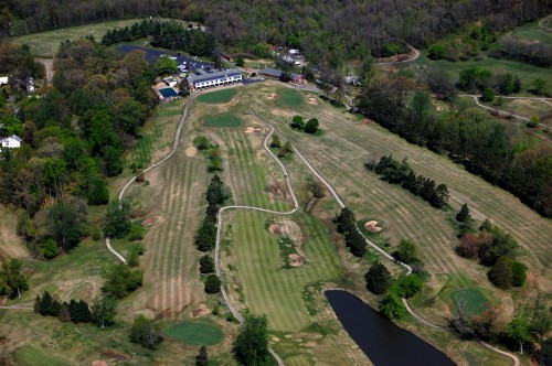
Locate a field at Country Club?
Q: Where would you suggest these fields be located?

A: At the country club, for the first one, perhaps. Then, wherever sufficient ground can be obtained at a reasonable price southwest of town, right on the edge of town.

Commercial Flights
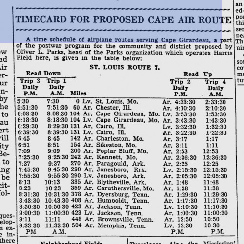
There would be scheduled commercial flights to and from Cape and St. Louis and Chester (17-minute flying time), Cairo (9 minutes).

Other airport stories


Lohmann Fixture Company

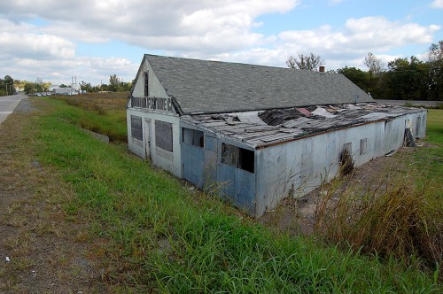
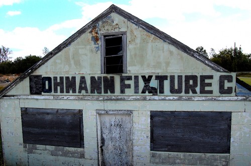
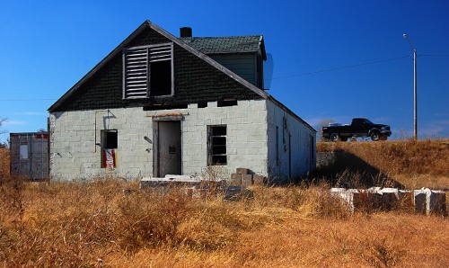
Lohmann Fixture Company is about the only old building left in what used to be called Smelterville. You have to look hard to see it peeking above South Sprigg Street.

The road has been raised to keep it from flooding. Seeing how far Lohmann’s is below street level will give you an idea how low the community was and why it flooded every few years.

Lohmann’s in 2008

Brother Mark and I paused on one of our bike rides to shoot a few photos of the building in 2008.

Lohmann’s in 2010

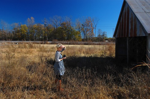
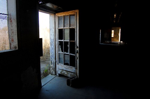
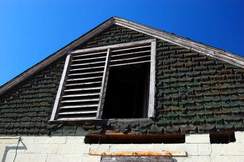
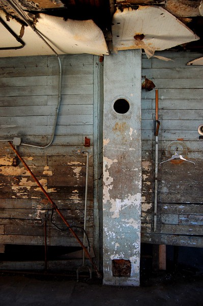
Niece Laurie Everett wanted to go on a photo ramble in the fall of 2010. We spent some time down at the 1929 railroad bridge over Cape LaCroix Creek, then we did some “peeling paint” photos of the old building.

Tool Ghosts

I always like to spot traces of things no longer there.

Not much info on business

I saw some Missourian briefs about rummage sales to be held in the building, but not many other stories. The 1968 City Directory had a listing for Lohmann Fixture Company at 2300 South Sprigg. The building has 2200 on the front of it, but I assume it’s the same business. Clarence A. Lohmann was listed as the president of the company.

Clarence A. Lohmann

I found an obituary for Clarence A. Lohmann in the October 13,2008, Missourian.

Clarence A. Lohmann, 89, of Cape Girardeau died Sunday, Oct. 12, 2008 at The Lutheran Home in Cape Girardeau.

He was born May 11, 1919, in Cape Girardeau, son of Edward and Emma Kohlfeld Lohmann. He and Vera (Felter)Lohmann were married Nov. 18, 1939, in Chaffee, Mo.

Served in World War II

Lohmann was owner of Lohmann Supply Co. and Semo Leasing for 60 years. He served in the U.S. Navy in World War II and was a member of VFW Post 3838 and American Legion Post 63. He was a member of St. Vincent de Paul Catholic Church, where he served as Eucharistic Minister, and was a member of Cursillo, St. Vincent Society Men’s Club. He also was a member of Father Marquette Knights of Columbus 11205 and Thomas A. Langen 4th Degree Council and served as Faithful Navigator. He belonged to the Jesuit White House Retreat.

He was a former member of the Jaycees and charter member of the Exchange Club of Cape Girardeau for 50 years. He formerly belonged to Kimbeland Country Club and the Refrigeration Service Engineer Society. He graduated from Rankin Technical School of St. Louis.

Mr. Lohmann’s family

Survivors include his wife, Vera Lohman of Cape Girardeau; a son, Dan (Tammy) Lohmann of Cape Girardeau; a daughter, Jane Lohmann of Houston; a grandson, Kirk Lohmann of Cape Girardeau; and a brother, Elmer Lohmann of Scott City.

He was preceded in death by his parents; three brothers, Elvis Lohmann, Arnold Lohmann and Richard Lohmann; and a sister, Erma Richter.

Photo gallery of Lohmann’s Fixture Company

Here are a few more photos of the building, including an aerial. Click on any photo to make it larger, then click on the left or right side of the image to move through the gallery.

Civil War Fort A

Everybody who grew up in Cape learned about Fort D. Maybe you even went on a field trip there.

If that was D, were there Forts A, B, C and E? Well, there wasn’t a Fort E, but A, B and C existed.

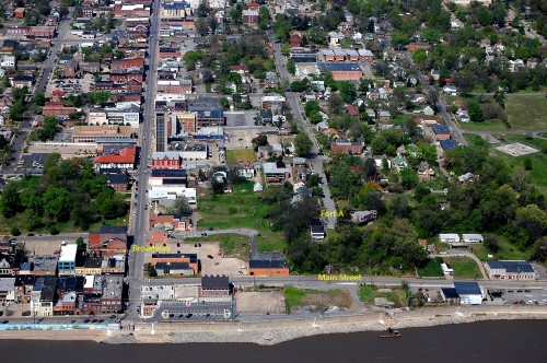
Missourian librarian Sharon Sanders wrote about efforts to preserve Fort A, which was atop the bluff at the end of what is now Bellvue Street. Her research, as always, is worth reading. (Click on the photos to make them larger.)

She’s not a dry historian, either. she likes to toss in tidbits like, “A 1922 story reports 12-year old Wilson Gibbs chased a rabbit into a a cave at the site. While the rabbit made its escape, Gibbs did stumble upon two jugs of moonshine. A law-abiding youth, Gibbs turned the illegal liquor in to Justice of the Peace C.M. Gilbert. There’s no mention of whether anyone claimed the whiskey.

Scenic lookout proposed

In 1960, Sharon reports, there was talk about creating a scenic overlook/turnaround at the end of Bellvue. The project never got anywhere.

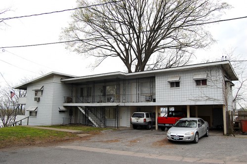
Here’s what’s on the right side of the street today. That apartment building has been there since at least the mid-60s, because Missourian reporter Arlene Southern lived in one of the first floor apartments.

Fort B became SEMO

If you have good eyesight, you MIGHT be able to spot a gray marker in the median of Normal Avenue just east of the red brick crosswalk between Kent Library and Academic Hall. That marker notes the location of Fort B, which was to guard the Perryville and Jackson Road approaches to Cape Girardeau.

St. Francis Hospital site was Fort C

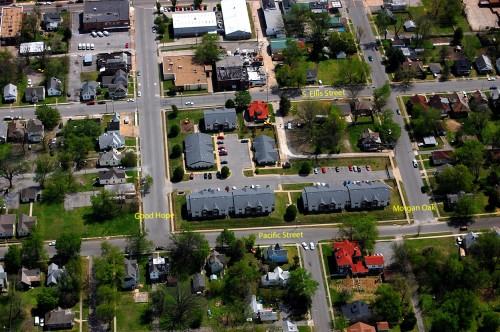
The old St. Francis Hospital site in the middle of the marked streets was the location of Fort C. It’s occupied by the Fort Hope housing development today.

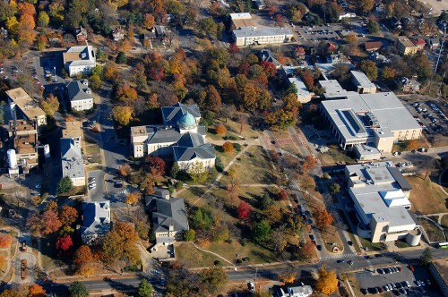
I’ve written about some of the landmarks in this photo.

Pfisters from the Air

Cape IT director Eric McGowen, a reader, asked if I’d like to see the Jackson Courthouse and the Common Pleas Courthouse from top to bottom – bell towers to dungeon. Do bears squat in the woods? You bet.

Bright and early (for me), Friend Shari came down from St. Louis to carry lights and tripods, and we met up with Eric and Don McQuay, public works director. I’ll post the courthouse pictures later.

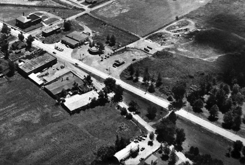
What we ran across was almost neater than the landmark buildings. In the basement of the Common Pleas Courthouse hung three framed prints. As soon as I saw the round shape, I knew immediately that it was on the few photos of Pfisters I’ve seen.

This is a section of the photo showing the Broadway – Kingway split just west of Kingshighway. Click on the photos to make them larger. I made them a little bigger than usual, so they may take a few extra seconds to load.

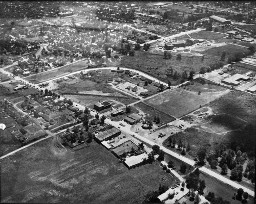
A wider shot

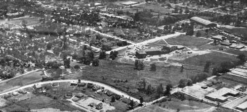
This is the uncropped version. The Broadway – Kingsway split is at the bottom right. The next street to the left is Clark. The curved one is Thilenius. Central High School is at the top right. Franklin School is at the top left.

I used a polarizing filter to cut as much glare as I could, but there’s still some left. There was nothing on the photos to indicate who might have taken them.

Central High School

This is an enlargement of the Central High School area. It looks like the school might still be under construction, which would mean the picture was taken sometime around 1952 or 1953. The first classes were held there in 1953.

Franklin School is at the top left. The Grace United Methodist Church hasn’t been built yet. I’m not even sure that the streets are paved. Caruthers Avenue, especially in front of the school, doesn’t look like it. Themis Street has some gaps between houses.

2011 aerial photo of Central High

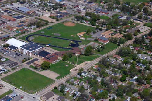
It’s a junior high school now, but to me it’ll always be Central High School. I didn’t have one taken from the same direction as the 50’s photo. This is looking southeast to northwest, diagonally opposite of the older picture.

Caruthers and Independence is on the lower left. The long, red building in the middle of the top of the picture is where Pfisters would have been. Grace United Methodist Church is on the right, near the intersection of Caruthers and Broadway.