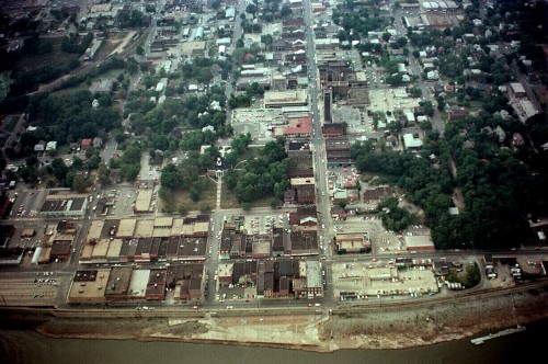
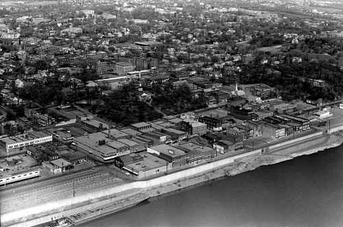
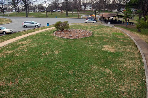
 Like Terry Hopkins pointed out in his moving commentary yesterday, this is the time of year when the Capaha Park Pool should be opening for another swimming season. Instead, heavy equipment moved in to bury bricks, mortar and memories.
If you ever dipped a toe in the Capaha pool, I’d encourage you to go back and the read stories written by three life guards from the Class of 1966. All of them said the pool changed their lives. The comments that have been left here, Facebook and The Missourian are equally touching.
I wonder how many years it will take before the memory of our pool is as distant as the one that preceded it. Probably most of us never turned away from the diving area to look at a tiny concrete oval below us. That was the original pool.
A rite of passage
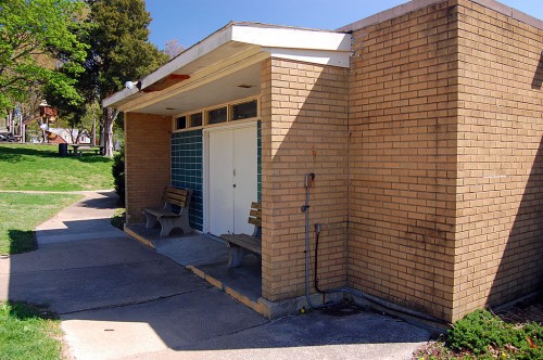 Going through those double doors by yourself was a real rite of passage. Not quite equal to getting your driver’s license, but pretty close. You’d go through the doors, pay your entrance fee, then get issued a wire basket with a safety pin-like number on it that you used to claim it when you left.
You’d go into the communal dressing room where a young boy couldn’t help but feel woefully insignificant and insufficient when he confronted teenage boys and men wandering around in their all together. Fortunately, the dressing rooms didn’t have a ceiling or roof, so you could spend your time looking up at the sky like there was something of interest to see up there.
You’d better look showered
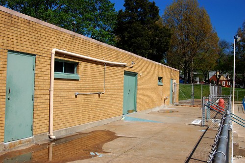 Somewhere, there was a sign that said something to the effect that showers were required before swimming. Woe be the person who didn’t look at least superficially wet when they exited the dressing room.
One the way out, you’d splash through some kind of dark liquid that I suppose was intended to kill whatever creeping crud you might have on your feet. The final step was to turn in your metal basket and clip the safety pin thingy to your suit before stepping through the second set of double doors leading to nirvana.
On the east end of the building was the concession stand. The thing I remember most was some kind of thin, taffy-like, multi-colored candy that was sold between sheets of waxed paper. A chain link fence bisected the stand so people outside in the park who hadn’t paid for admission to the pool could still buy things.
Shallow water and toddler pool
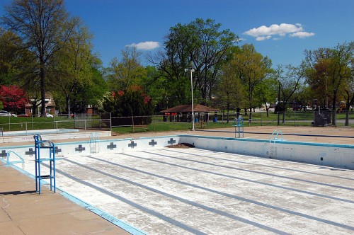 The shallow end and toddler pool were to the east.
Toddler pool was always warm
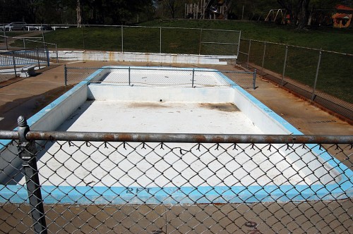 If you were REALLY young or had smaller siblings in tow, you’d turn left toward the kiddy pool. The water in there was always warm. I never liked to contemplate whether it was because it was shallow and would heat up quickly or if it was a byproduct of all the toddlers dunked in there.
Water got deeper to the west
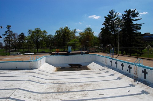 When you got taller or learned how to swim, you’d migrate from the shallow eastern end of the pool to the rope at the west end of the L that marked the deep end. If the life guards doubted your ability, they’d whistle you over and make you demonstrate your swimming prowess.
Diving area was the best and worst of worlds
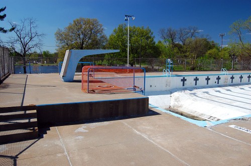 After you had spent some time getting up enough courage to jump off the edge of the pool doing cannonballs and splashing around, it was time to graduate to the diving boards.
I don’t know how far above the water the low dive was, but it was by no means LOW the first time I got up enough nerve to climb up on it. It felt like it was at least 10 stories high. Still, it didn’t take long for me to transition from holding my nose and jumping to doing some actual bounce-the-board dives.
High dive required oxygen, Sherpa guide
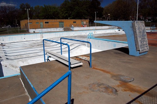 If the LOW dive felt high, then the actual HIGH dive was somewhere akin to Mount Everest. I expected that you’d be assigned a Sherpa guide and supplementary oxygen to scale those heights.
I don’t know if it was an official rule, an unofficial understanding or just a sadistic whim of the life guard who saw me climbing the steps to the high dive for the first time.
“That’s a one-way trip”
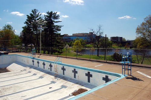 “That’s a one-way trip,” he growled. Well, to be accurate, if it was Terry Hopkins, it really might have been a squeak, but it sounded like a growl to me at the time. “If you go up that ladder, there’s only one way to get off the diving board and that’s off the end. There’s no turning back.”
Fearing the guard more than the certain death that was facing me, I opted to keep climbing. Not only was that sucker HIGH, but the board jiggled and quivered like it was just waiting to launch me off into outer space of its own volition.
My toes were clawing air
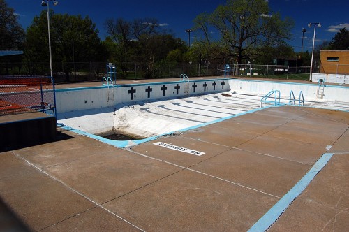 I think I was about 12 when I made the journey UP the ladder, but I’m pretty sure I was old enough to need to shave by the time I got up enough nerve jump off the board feet-first, holding my nose. My eyes were clinched tightly closed so I couldn’t see, but I bet my toes were clawing air like a cartoon character all the way down.
They say the water was only 12 feet deep under the boards, but they just have been using some kind of foreign tape measure that computed in light years, not feet.
I was hooked
Once I got back into air and light, I did a quick visible body part check, divided by two and came out with an even number. Then, I made a beeline for the high dive. For the rest of the summer, I wore a rut in the concrete going from water to diving board. I never got good, but I got where I didn’t embarrass myself.
Circle marked home of Millie the Duck
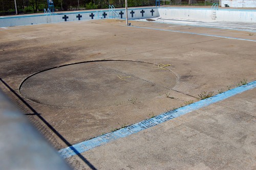 The south side of the pool had a large concrete pad that was perfect for lounging around. This circle marked where a huge tree stood. One day someone called the newsroom to report that one of the lagoon’s ducks was sitting on a nest of eggs in the gravel under the tree.
Summer in the newspaper business was called “the silly season,” because everything slowed down and the most superficial of stories could find themselves on the front page. Consequently, Denny O’Neil and I were dispatched to interview Millie the Duck.
Denny was a heck of a writer. He did the words when I got the wild idea of using infrared film to shooting the audience watching Help, the Beatles movie at the Esquire. I also talked him into covering a Flying Saucer Convention.
Anyway, Denny did too good a job. Everybody in town loved the story. Editor jBlue let us know we were on permanent Millie duty until the eggs hatched. I was getting paid by the photo, so I didn’t care; Denny became less and less enchanted with the assignment as the ducklingless days passed. I’ll save the full Millie saga for later when I find all the photos.
Pool a metaphor for life
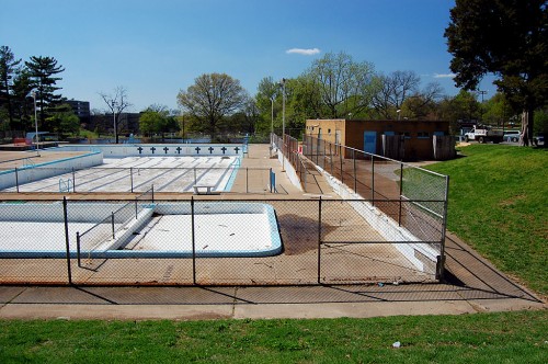 The pool was a metaphor for life for most Boomer Cape Girardeau kids. We started in the warm waters of the toddler pool under the watchful eye of our parents; then we were given the freedom to explore the shallow waters under the guidance of life guards not a whole lot older than we were. We got brave enough to venture into the figurative and literal deep waters and finally graduated with that amazing first flight off the high board.
Scatter my ashes above the pool
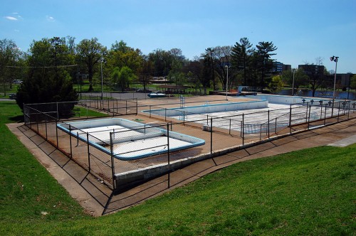 Terry Hopkins wrote yesterday, “At one time, I wanted my ashes scattered on the hill above the pool just so I could be close and watch people having fun at a place I loved.”
Looked a little seedy at end
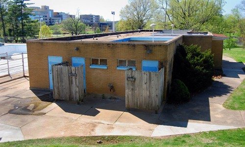 The facility was looking a little ragged toward the end. The main building could have used some pressure cleaning. The tank itself looked pretty good, but some of the deck needed concrete patching.
Jacqie / Bill Jackson wrote yesterday that the method for keeping the water treated and in balance was dangerous and “seat-of-the-pants” even in the 70s, so the city probably was justified in ending an era.
When I shot these photos in April, I knew the pool wasn’t going to open this year.
Still, there’s a big difference between knowing the patient is terminal and getting a call in the middle of the night that the life journey is over. Wife Lila said she kept going back and rereading the story all day. It’s like she lost a friend.
Overview of the park
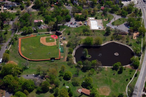 Here’s an overview of Capaha Park taken April 17, 2011. The ball field is on the left; the lagoon is on the right and the L-shaped swimming pool is above the lagoon. Broadway is to the right and Cherry Hill is in the lower left corner. The-red roofed building at the bottom is the band shell.
If you have a story to share about Capaha Pool, please leave a comment. I’ve been amazed at how much the facility meant to over a half-century of children and their parents.
Technical nit: for some reason, the blog will sometimes not show new content if you’ve been to the page before. If you press Ctrl-F5, it will refresh your browser and show you the new material.
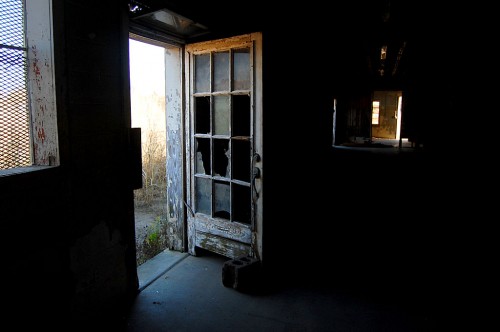 Think of this is kind of a visual palette cleanser after several days of serious posts about things that are important to me that are going away.


