Another Full Moon

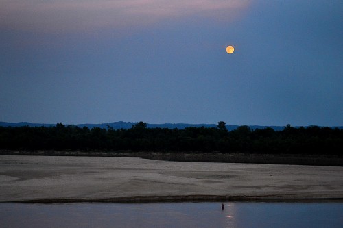
When you’re shooting your second full moon of a visit, it’s probably time to start packing your bags. The moon phase ap on my Droid showed that the orb was 97% full last night, so I told Mother we better be ready to saddle up to shoot it tonight.

We pulled in to the parking lot at the base of Cape Rock to find eight or ten cars getting ready for the free entertainment. Just about that time, a long, long, long southbound freight rolled by in front of us. It kept coming and coming and coming, slowing all the time. Finally, with the last three empty hopper cars and a pusher engine blocking our view, it stopped. Dead, put-a-penny-on-the-tracks stopped.

We decided to go to the top of Cape Rock, but feared that it would be parked solid. To our surprise, there was only one car parked there, and it moved on, leaving us some prime real estate to watch.

While I was setting up my tripod, a guy on a bike rolled up. We did all the ritual chicken dances that people with similar interests do and got so involved that I didn’t pay much attention to the horizon. I’d look over my shoulder from time to time and think, “Nope, not yet.”

Well, I had misjudged where the thing was going to come up. On one of my shoulder checks, I looked a little more to the south and did one of those, “Whoa! Where did THAT come from?” Of course, I pretended that I had been patiently WAITING for the moon to get 10 degrees out of the water before shooting.

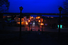
I shot a few frames with the longer lens on my video camera, but I like this one better because it shows how low the river is now. That’s one BIG sandbox down there. The river’s about three feet lower than it was when I shot the little picture above from Cape Rock last fall.

Checked out the casino

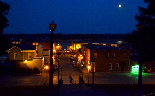
When some clouds covered the moon, we headed toward town. I thought maybe there would be some night working going on at the casino, but it didn’t look interesting. I opted not to try for a moon shot from the floodwall and the bridge because I had done those before. I decided to see what the view was like from the Common Pleas Courthouse.

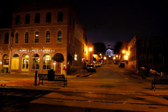
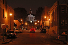
When I came around the corner, the two women going down the steps were standing shoulder to shoulder trying to get a moon photo with their camera phones. I didn’t have the heart to tell them that the puny little flashes built into those cameras weren’t going to do much good at lighting up downtown OR the moon. I didn’t do much better. It was already pretty small in the sky by now.

This view down Themis Street is pretty similar to the one I shot in March of  2010.

I may try this angle for my next full moon shot, but it had better not be taken on THIS trip..

Common Pleas from Dome to Dungeon

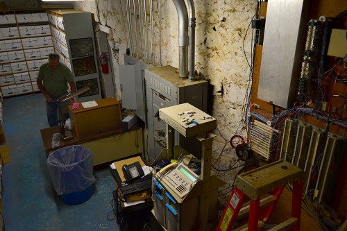
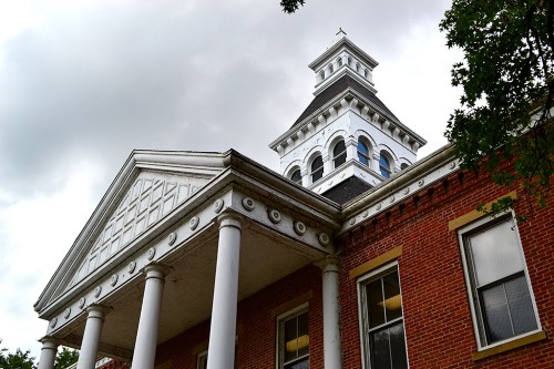
Eric McGowen and Don McQuay led Friend Shari and me on a tour of the Common Pleas Courthouse. Like everyone else, we had heard the stories of the dungeon in the basement and the secret tunnels leading to the river. So, let’s get to the bottom of this, if you’ll pardon the pun.
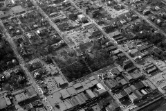
The basement is semi-finished in one area and used for record storage, phone and networks equipment, Christmas decorations, miscellaneous junk and three framed aerial photographs, one of which was of Pfisters and Central High School in the early 1950s.

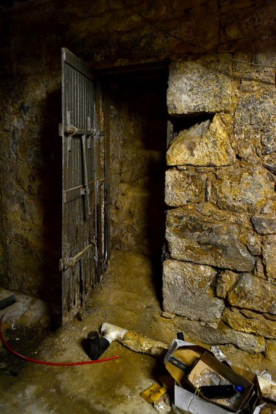
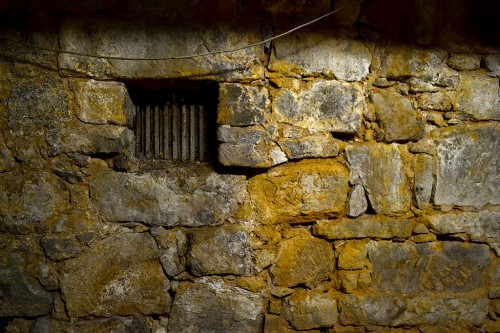
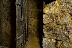
“Dungeon” has dirt floor

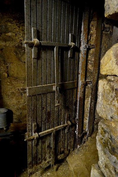
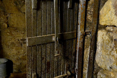
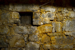
I’m still trying to figure out this room, which is located north of the storage room. It contains a heavy steel door and an iron lattice opening that must have been for ventilation.The dirt floor is just as it was during the Civil War.

Which side is the lockup?

The passageway through the door doesn’t lead anywhere today.

The locking mechanism had to be on the “outside”, making this room the secured area. The only problem is, we couldn’t figure out how you would get to it unless it once opened to the outside.

Forget about the tunnels

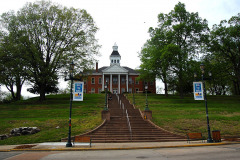
Let’s get rid of the tunnel theory first off: The Common Pleas Courthouse is located on one of the tallest hills in Cape. If you tunneled out from the basement, you’d come out in thin air. Digging straight down would take more work than anyone would have undertaken.

An excellent resource for history buffs interested in the courthouse is the National Register of Historic Places registration form. It’s an interesting read, but it doesn’t mention tunnels. (It’s a large file, so it might take awhile to download.)

Rebel guerrilla lynched

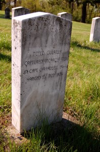
It does have the background of a grave marker I spotted at the Bloomfield’s Stoddard County Confederate Memorial.:

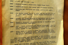
An infamous case centering on the Court of Common Pleas occurred in February of 1864 when a notorious guerilla, John Fugate Bolin, was captured by Union forces near Bloomfield, Missouri. He was brought back to Cape Girardeau and according to local tradition was kept in the basement of the courthouse. Army telegraph messages back and forth to St. Louis discuss whether to hold Bolin for trial or to just kill him outright. General Clinton Fisk in St. Louis advised Colonel J. B. Rogers, the regimental commander stationed in Cape Girardeau, to hold him for trial. However, on the night of February 5th a large crowd of citizens and soldiers took Bolin from the courthouse, placed him on a wagon, rode him to a tollgate on the Bloomfield Road south of Cape Girardeau and hung him. Fisk afterwards commented that it would “hardly be necessary” to give Bolin a trial. Suggesting Fisk’s reply might be seen as “winking” at the illicit act and to allow him to “better be able to restrain my men” in the future, Rogers requested, and received, a reprimand for allowing mob rule to govern the day. This is one of the few situations in Missouri where the impromptu execution of a guerilla leader was discussed in official correspondence.

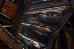
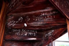
Stairway gets narrow, twisty

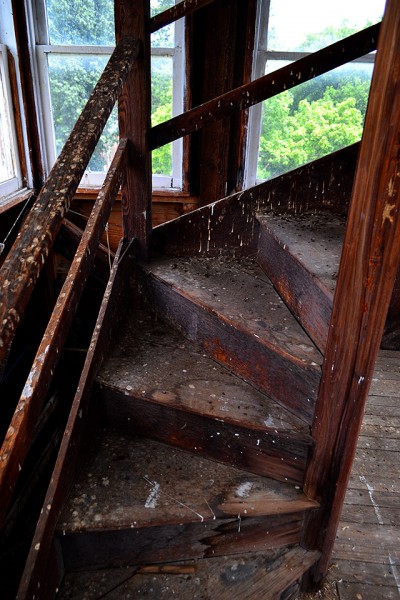
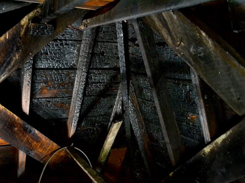
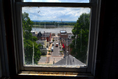
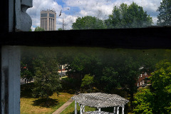
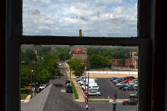
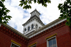
The stairway to the dome felt solid, but it got narrower and more twisty the higher I walked. This is the level where I shot photos of the courthouse grounds and surrounding neighborhood.

I’m glad I hadn’t read up on bird droppings and histoplasmosis when I made this journey.

County seeking grant

The Missourian had a story July 24, 2012, reporting that the county commission will seek a historic preservation grant from the Missouri Department of Natural Resources to support repairs to the building. I don’t know if the money will go for replacing charred timbers in the dome.

Iconic landmark

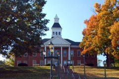
I’d have to say that the courthouse, Mississippi River bridge (old and new) and Academic Hall are Cape’s most iconic landmarks.

Common Pleas Courthouse photo gallery

Click on any photo to make it larger, then click on the left or right side of the image to move through the gallery.

Civil War Soldier

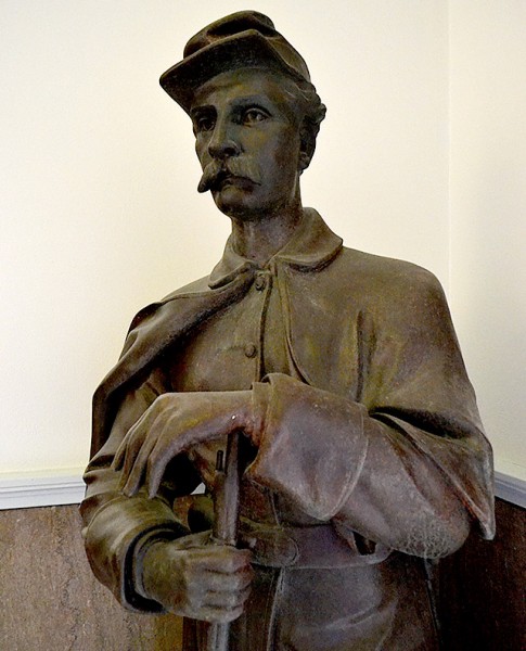
When IT director Eric McGowen, Friend Shari and I were on our way up to the Jackson County Courthouse’s bell tower, public works director Don McQuay mentioned something about a figure standing in a dark corner. To be honest, I was more interested in getting up to the dome where the neat stuff was before it got too hot, so I didn’t stop to look at it. (I’ll show you the neat stuff later.)

On the way back down, Don pointed him out again, prompting me to take a closer look. “Know who he is?” Don asked.

Sounded like a trick question to me, so I said, “Not a clue.”

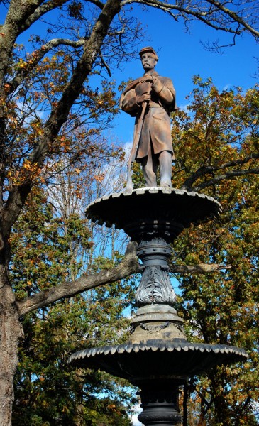
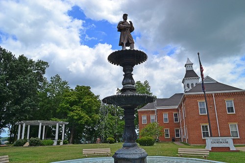
“He’s the Union soldier who used to on the fountain at the Common Pleas Courthouse.” Don said.

A tree limb hit the statue May 12,2003, and broke it into more than 200 pieces. “I picked up most of them in a five-gallon bucket, he said.” At first it looked like the old soldier, erected by the Women’s Relief Corps, and dedicated on Memorial Day 1911, was a goner.

Alan Gibson to the rescue

Alan Gibson, a Dexter sculptor, said he’d try to put the martial Humpty Dumpty back together. Once he did that, he made a mold of the original and recast it with polyester resin and bronze.

Here is a Fred Lynch gallery of photos of the soldier being lifted back up on the fountain.

Shari and I were amazed at the job Gibson did. We couldn’t feel a single joint or seam where the pieces had been put back together.

Tree shadowed statue

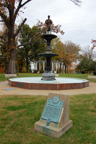
When I shot the statue as part of a story on Common Pleas memorials in October 2011, there was a large tree behind the statue. It might have even been the Killer Tree itself (not to be confused with Jackson’s Hanging Tree).

Grounds look naked

When I shot this photo July 13, 2012, the tree was gone, leaving a gap like a missing tooth. You wouldn’t think a missing tree would cause the grounds to feel out of balance, but it did. I guess I just got used to seeing it there even if I never really noticed it until it was gone.


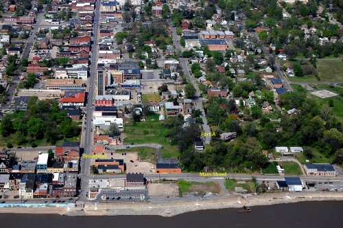
Civil War Fort A

Everybody who grew up in Cape learned about Fort D. Maybe you even went on a field trip there.

If that was D, were there Forts A, B, C and E? Well, there wasn’t a Fort E, but A, B and C existed.

Missourian librarian Sharon Sanders wrote about efforts to preserve Fort A, which was atop the bluff at the end of what is now Bellvue Street. Her research, as always, is worth reading. (Click on the photos to make them larger.)

She’s not a dry historian, either. she likes to toss in tidbits like, “A 1922 story reports 12-year old Wilson Gibbs chased a rabbit into a a cave at the site. While the rabbit made its escape, Gibbs did stumble upon two jugs of moonshine. A law-abiding youth, Gibbs turned the illegal liquor in to Justice of the Peace C.M. Gilbert. There’s no mention of whether anyone claimed the whiskey.

Scenic lookout proposed

In 1960, Sharon reports, there was talk about creating a scenic overlook/turnaround at the end of Bellvue. The project never got anywhere.

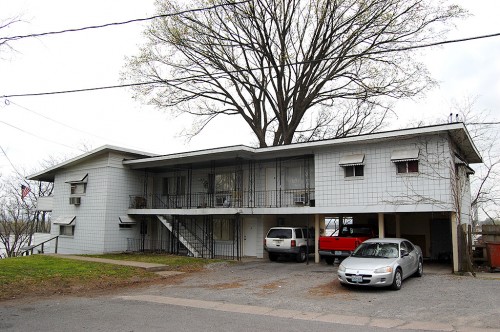
Here’s what’s on the right side of the street today. That apartment building has been there since at least the mid-60s, because Missourian reporter Arlene Southern lived in one of the first floor apartments.

Fort B became SEMO

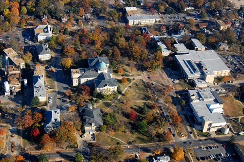
If you have good eyesight, you MIGHT be able to spot a gray marker in the median of Normal Avenue just east of the red brick crosswalk between Kent Library and Academic Hall. That marker notes the location of Fort B, which was to guard the Perryville and Jackson Road approaches to Cape Girardeau.

St. Francis Hospital site was Fort C

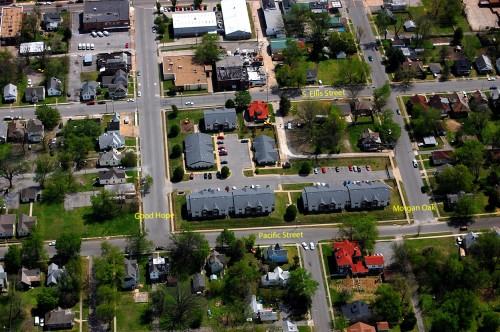
The old St. Francis Hospital site in the middle of the marked streets was the location of Fort C. It’s occupied by the Fort Hope housing development today.

I’ve written about some of the landmarks in this photo.