That Dammed Sprigg Street Sinkhole

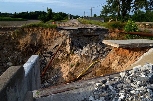
Cape LaCroix Creek sinkhole 07-19-2015I always take a run down check out the cement plant quarry, but the trip takes a little longer now that Sprigg is closed at Cape LaCroix Creek due to a persistent sinkhole. In the 2011 flood, water under pressure from the river followed cracks and almost filled the quarry.

Sinkhole swallowed water lines
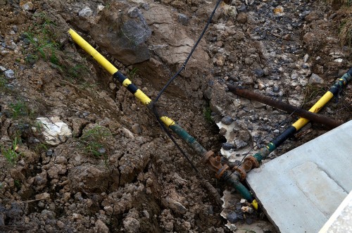
Cape LaCroix Creek sinkhole 07-19-2015Mother Earth was hungry for Cape’s infrastructure.

The Southeast Missourian had a story by Samantha Rinehart on August 18, 2015, that reported the Cape city council had approved allowing crews to begin the design and construction phase of building a bridge that will span the sinkhole area. The cost had lots of commas and zeroes.

Upstream dam
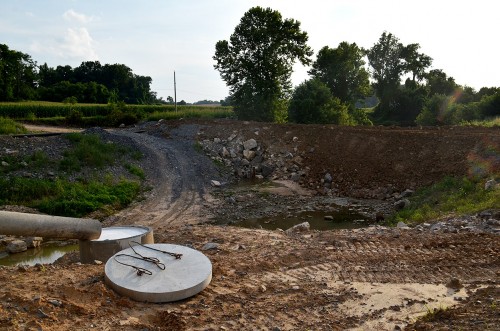
Cape LaCroix Creek sinkhole 07-19-2015When I went there on July 19, I was surprised to see a dam upstream of the bridge to keep Cape LaCroix Creek from flowing into the sinkhole area. A fairly strong thunderstorm had moved through over the past couple of days, so I wondered where all that water had gone.

Dam to keep Mississippi out
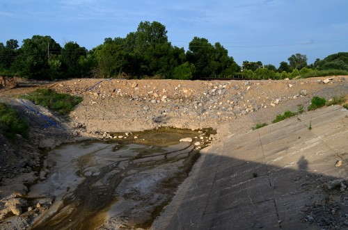
Cape LaCroix Creek sinkhole 07-19-2015There was a corresponding dam on the other side to keep the flooding Mississippi out. I didn’t have any desire to have my shoes sucked off wading through gumbo, so I elected to wait for a dryer day to explore.

Lohmann Fixture Company
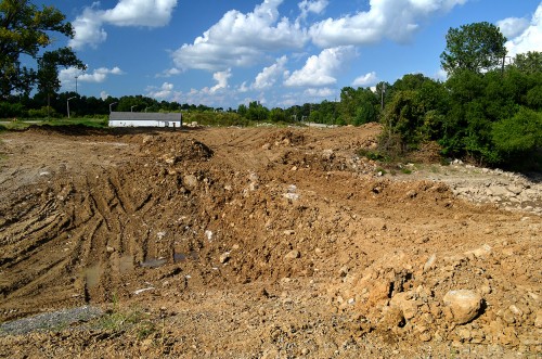
Dammed Cape LaCroix Creek 08-17-2015By August 17, it was dry enough to check out the Mississippi River dam. The white building sticking up in the background is the old Lohmann Fixture Company.

1929 railroad bridge
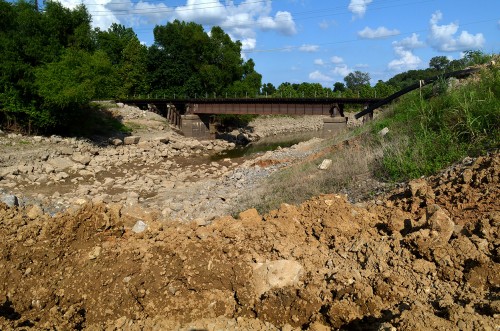
Dammed Cape LaCroix Creek 08-17-2015The river was back to its normal levels, so nothing was lapping up against it. The black pipe off to the right must have been how the water from upstream got past the sinkhole area. I have a hard time believing a 10 or 12-inch pipe could handle the volume of water dumped by the last rainstorm, but it must have. The railroad bridge in the photo was built in 1929.

No KKK and swastika in 2010
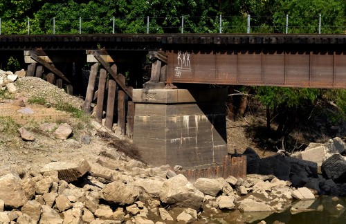
Dammed Cape LaCroix Creek 08-17-2015When I shot the 1929 railroad bridge in 2010, it didn’t sport the KKK and swastika that it does here.

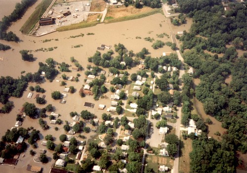
 

1993 Flood – Red Star

Aerial 1993 FloodIt’s pretty easy to tell Wet Cape from Dry Cape during the 1993 flood. This aerial photo shows the Red Star District looking south from about 4th Street. The city’s floodwall is barely keeping the Mississippi River out of the town. (Click on the photos to make them larger.)

Buyout left green spaces

Red Star looking south to Isle Casino Cape Girardeau siteThis 2011 aerial shows a lot of empty green spaces left after many residents took buyouts to keep from going through this again. This is looking south from just below Johnson Street. The photo was taken just as clearing for the Casino was beginning.

2011 Red Star looking west

Aerial photo of Cape Girardeau Sand Co and Red Star District 04-17-2011This aerial showing the Cape Girardeau Sand Company and what is left of the Red Star District was taken April 17, 2011. The concrete pad at the left of the photo is what we used to call Honker’s Boat Dock. To the left of Sloan Creek is the area that is being cleared for the Isle Casino Cape Girardeau. The light-colored building at the top center is the Show-Me Center.

Commerce from the Air

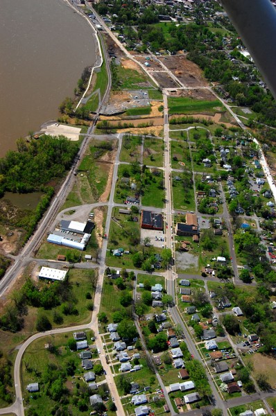
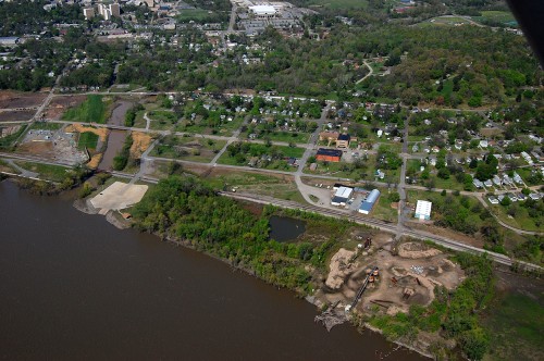
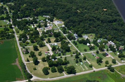
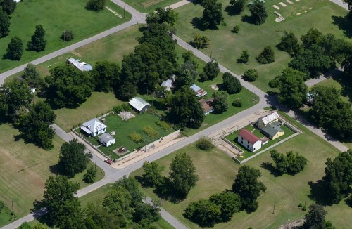
Aerials Commerce Area 08-13-2014Ernie Chiles and I were on a photo mission to shoot Cairo and the confluence of the Ohio and Mississippi Rivers on August 13, 2014.. Our trip took us over Commerce on the way back. There are lots of open lots where homes and businesses used to be after the floods of 1973, 1993, and 2011 took their toll on the town.

When I did an earlier story on Commerce, I noted that the 2010 Census recorded a population of 67 in 30 households, down from 110 people in 42 households ten years earlier. I wonder how many will be left in 2020?

Tried to fight the floods

Aerials Commerce Area 08-13-2014At least two homeowners tried to hold back the river with concrete floodwalls. I don’t know if they succeeded. Click on the photos to make them larger.

The Flood of 1913

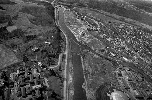
Aerial photos of Hocking River relocation 04-09-1970When I moved to Athens, Ohio, in 1967, I sneered at the puny Hocking River: “You call that a river? Where I come from, on the banks of the Mighty Mississippi River, we’d call that a creek at best.”

A year later, the Hocking would flood a significant part of the campus, prompting a major re-routing of the river. In this 1970 aerial, the old channel meandered through the heart of the low part of the campus. A dike or plug kept the old river from flowing down the new, straighter, wider channel during construction. (You can click on the photos to make them larger.)

Muskingum River bridge

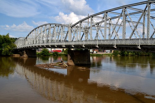
Malta OH riverfront 08-24-2014Malta was just down the road from Miners’ Memorial Park and Big Muskie’s bucket, so I paused to give Curator Jessica a chance to photograph this bridge over the Muskingum River because there was talk that it might be replaced. I left the motor running and stayed near the van.

Twin City Saloon

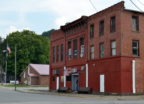
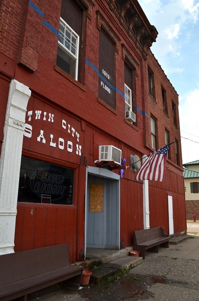
Malta OH riverfront 08-24-2014I was trying to make out what that blue line was on the red building when a guy came out, saw me and started pointing up at it. He walked over and struck up a conversation. He’s the owner of the Twin City Saloon, and that line represents how high the water got during the Flood of 1913.

We chatted a bit, then I mentioned that Curator Jessica worked at the Athens museum and that we were lollygagging around the state visiting interesting places. When she walked back to where we were, he said, “I have something you need to see.”

Jessica gets kidnapped

Malta OH riverfront 08-24-2014I didn’t want to leave the van unlocked and running, so I volunteered to move the van closer and lock it up. When I completed my task, I headed over to where I thought the couple had gone. No bar owner, no Jessica.

“That’s great,” I thought. “I’m going to have to go back to Athens to tell Hubby TJ that Wife Jessica has been sold down the Muskingum River for whatever curators are good for, and that it’s my fault for not keeping track of her.”

I decided to check the bar. It had a Closed sign up, but the door was unlocked. There was Jessica and the owner looking over some cool artifacts that had been in the building for more than 100 years.

The Great Flood of 1913

I can rattle off significant Mississippi River Floods: 1927, 1941, 1973, 1993, 2011, but I had never heard of the Great Flood of 1913. The History Channel said “It is estimated that the Great Flood of 1913 killed more than 1,000 Americans, making it the country’s second-deadliest deluge (behind only the 1889 Johnstown Flood, in which more than 2,200 lost their lives). The destruction cut across 14 states—reaching from Vermont to Michigan to Louisiana—making it the country’s most widespread natural disaster.

“The apocalyptic storm that caused the Great Flood of 1913 impacted more Americans than the San Francisco Earthquake and Fire of 1906, the Hurricane of 1938 and many other better-known natural disasters. So why has history largely forgotten it? Geoff Williams, author of a book on the Great Flood, said it’s because the impacted communities viewed the disaster as a local, rather than a national, calamity. ‘If you lived in Dayton, it was the Great Dayton Flood. If you lived in Indianapolis, it was the Great Indianapolis Flood. People thought of it in very local terms although it was a huge regional flood.‘”

Look at Marietta’s flood levels

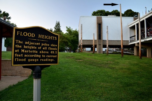
Marietta Ohio River 08-24-2014When we got down to Marietta, Ohio, there are some wooden poles that indicate the height of various Ohio River floods over the years. The tall pole at the right shows the March 1913 crest of 58.7 feet. The city’s website said that flood “The flood swept 120 homes away, knocked 200 homes off their foundations and water was eight feet deep in the old Post Office.”

That’s pretty impressive.