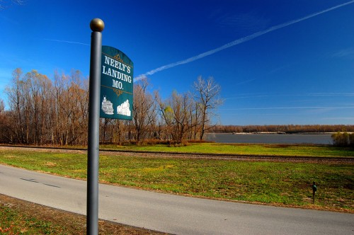
Tragedy at Neely’s Landing

Oct. 27, 1869, the steamboat The Stonewall, heavily laden with about 300 passengers, tons of cargo and 200 head of livestock was southbound on the Mississippi River near Neely’s Landing, bound for Cape Girardeau, Memphis and New Orleans. The river was low and the boat was running “slow wheel.”

A candle or lantern overturned or a passenger dropped a spark onto hay on the lower deck, which caught fire. Before the blaze was discovered, it had gained considerable headway.

Burning boat ran aground
An Oct. 27, 1936, Missourian reprised the incident on its 67th anniversary, drawing upon the memories of R.W. Harris, who was eight years old when the boat burned not far from his home at Neely’s Landing. When the crew couldn’t extinguish the fire, the captain headed the boat to the shore but struck a sandbar. The boat gradually turned in the current, causing the north wind to carry the fire through her.

Passengers caught like rats
“Panic stricken passengers were caught like rats on the blazing boat, between which and the Missouri shore was 150 feet or more of swift, icy cold water.” The flames were visible 1-1/2 miles away.

Some held onto horses
Four oarsmen went out on a skiff to rescue passengers. They were Lowrie Hope, Martin O’Brian, Frank West and Derry Hays,”the latter being a Negro.” They managed to rescue some passengers. Others were seen to walk into the flames; others jumped into the river, some forcing horses from the lower decks to swim while they clung to the animal’s tails.

209 to 300 drowned or burned

Depending on which account you read, somewhere between 209 and 300 persons perished from fire or drowning, making it one of the nation’s worst inland waterway disasters. Sixty or 70 victims were buried in a mass grave on the Cotter farm.

Scorched paper money found in safe
When the hull had cooled, what was left of the freight was salvaged and sold. Mr. Harris recalled that his father bought a firkin of butter from Wisconsin. One of the horses, scarred from burns, was long owned by Franklin Oliver, who called him Stonewall. When the boat’s safe was opened, only paper money, scorched to a crisp, was found, much to the public’s disappointment.

Bones still found 67 years later
Since the catastrophe, the paper said, the location has been called Stonewall bar. At low water, broken queensware, coal, nails, bits of iron and even bones are still reminders of the disaster.

Two accounts of the Stonewall’s burning

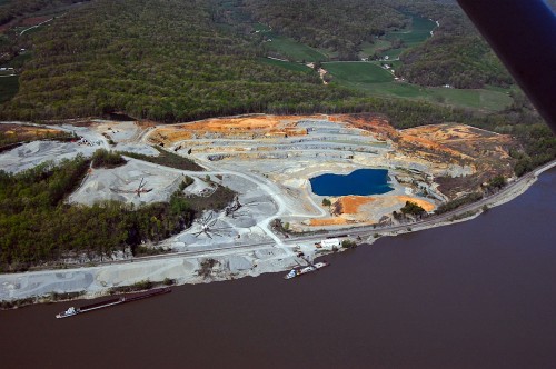
Large quarry north of Neely’s Landing

Neely’s Landing Quarry is located north of what remains of the town.

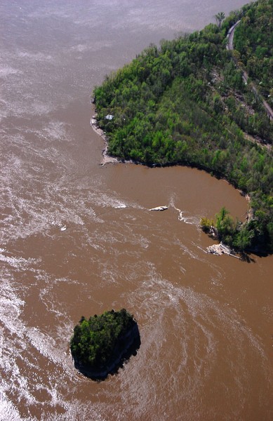
Tower Rock Quarry Exposed

When this aerial photo of Tower Rock was taken April 17, 2011, the river gauge in Cape was at about 43 feet and heading higher. The half-moon bay downstream and to the right of The Rock was a big circular corn field until the Flood of 1993, Gerard Fiehler of the Altenburg Lutheran Heritage Center and Museum said. The flood created a huge scour basin that’s a good 25 or 30 feet deep and several football fields across. Trees that grew along the basin are probably in the Gulf of Mexico today.

Click on any photo to make it larger.

We climbed Tower Rock in 2003

Brother Mark and I climbed to the top of Tower Rock in 2003. When the river stage in Cape is about six or seven feet, it’s possible to walk across to the rocky island. (It’s about 14 feet and falling on Nov. 7, 2011)

BE CAREFUL.  If the water’s more than a few inches deep, it can sweep your feet right our from under you. Missionary Father Marquette, who explored the area by canoe in 1673, said the “savages” believed Tower Rock to be “the demon that devours travelers.”

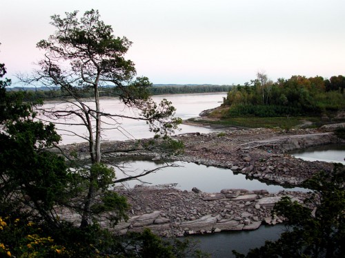
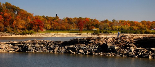
This view to the south shows the remnants of a quarry that was worked off and on for 135 years until almost all of the rock was exhausted in 1972. At normal river levels, only a little rock, if any sticks out of the water.

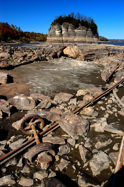
Low water uncovers artifacts

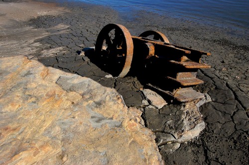
Despite the tremendous volume of water that sweeps over the area even in normal times, traces of track and tipple car wheels survive. These wheels could date to the late 1800s, Tower Rock, a book distributed by the Perry County Historical Society, says. The author thinks they may have been buried until the 500-year floor of 1993 uncovered them.

Acme Stone Crusher survives

Tower Rock identifies this rusting metal object as a steam-powered Acme rock crusher. A similar or the same crusher was used across the river in Grand Tower in the mid 1870s.

Steamboat tieup

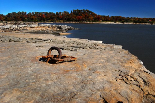
Not far from the crusher is this dual-ring steamboat tieup. There are several different styles on the jetty, the  oldest dating to the 1830s to 1850s. The quarry was most active from the Civil War through the Great Depression.

Now’s the time to see Tower Rock Quarry

If you’re going to go, go while the weather is nice and the river is low. This opportunity doesn’t come often.

Tower Rock isn’t some place you stop on the way to somewhere else. You have to REALLY want to go there. You start by passing through Altenburg on Missouri Hwy A. (It’s worth stopping at the excellent Lutheran Heritage Center and Museum. In fact, I printed a couple dozen scenic photo books for their gift shop to sell to gauge if there’s a demand for them. They’re going for $14, a steal.)

Might be longest suspension pipeline in world

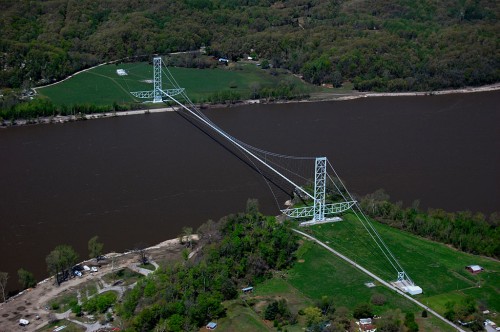
After going up and down some steep hills, just before you get to what’s left of the German pioneer village Wittenberg (Population: two buildings and three people), you’ll see a small sign off to the right pointing to Perry County 460, a steep and washboarded gravel road. As you drive along that road, you’ll spot what may still be the longest suspension pipeline in the world, that carries gas from Texas to Chicago. Not far from there, the road narrows and you pass through an area of fallen trees. I’ve spotted a momma deer and her two fawns twice on this stretch.

Stop, Look and Listen

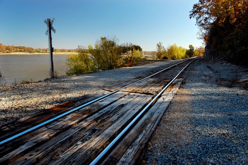
Now things get interesting if this is your first trip. You’ll make a sharp 90-degree bend to the left and cross over the BNSF railroad tracks and make an immediate right-hand 90-degree turn paralleling the river. After not seeing any trains at the crossing for years, two have passed on my last two visits: Stop, Look and Listen.

The stretch along the river is narrow and there’s a steep drop-off to the water, but you seldom meet a car. Eventually, you’ll come upon a parking area at the Tower Rock Natural Area, donated by Mr. and Mrs. Charles Bussen to the Missouri Conservation Department.

If there are any persimmons left, give them a try. You won’t find any anywhere else that are sweeter.

Shameless Plug: Buy My Book

{Shameless Plug: don’t forget to stop in at the Altenburg Museum to pick up a copy of my Tower Rock book. The museum folks are nice and they’re going to be setting up their Christmas Tree exhibit in the next week or so. It’s worth seeing.]

UPDATE: The Tower Rock book is now out of print.


Best River View in Cape

Cape has entered The Ugly Season. I’ve been living in Florida too long. Sure, we have torrential rains almost every day during the wet season, but they start and stop in about 15 minutes. Your side of the street could be getting pounded, but your neighbor across the street is perfectly dry. Florida rain knows its place and stays in it.

I woke up Thursday morning looking out the window at something that was between rain, mist and fog. The temperature was well above freezing, but I wasn’t as I ran around town taking care of some errands. It was like that when I woke up; it was like that when the sun went down. It’s probably going to look like that until about May.

330 N. Lorimier

One of my stops took me over to see Laurie Everett, Wife Lila’s niece, and proprietor of Annie Laurie’s Antiques. She and some other folks in the shop INSISTED that I had to go up a few blocks to an estate sale at 330 N. Lorimier.

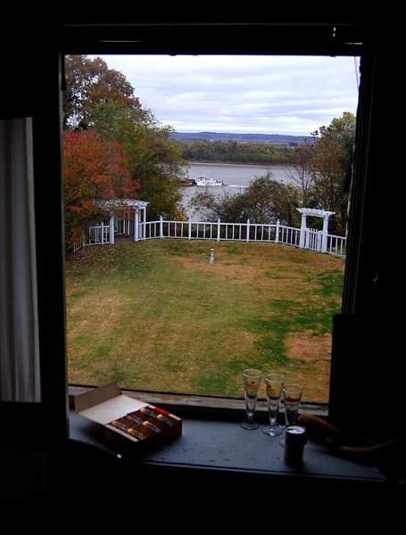
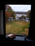
After the emotional tailspin I had last weekend at a home auction, I wasn’t sure I was ready to hop back on that pony. Besides, it was cold and rainy and they said I’d have to park and walk a fair distance. The thing that sold me, though, was Laurie insisting the house “had the best view of the Mississippi River of anywhere in Cape.”

She was right.

First private pool in Cape

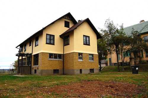
Cash box custodians Heather Meyer and Melanie Wood filled me in on some of the house’s history. It was built in the “19-teens” by the W. H. Harrison, the Harrison part of the H & H Building, one of Cape’s early tallest structures.

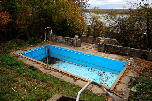
The Harrison family owned the whole block and built what was thought to be the first swimming pool in Cape Girardeau on a terrace below that white fence. Below THAT was a grass tennis court. The pool, another man said, needs some work, but was filled as recently as 1-1/2 years ago.

The tennis court “was a bit of a jungle,” but it’s been cleared up now.

Dr. Gibson came next

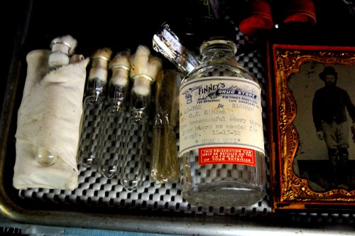
Dr. Gibson and his wife were the next owners. They passed it down to their son, Jim Gibson, a lawyer, and his wife Nancy. When Jim died, Nancy decided to move to a smaller place.

The estate sale will continue through Saturday, November 5. Here’s a link describing some of the items for sale. I don’t know how long the link will be valid.

Servants had the best view

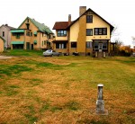
The photo at the top of the page was taken from a second floor window. The servants lived on the third floor. They had a smaller window, but an even better view. The door to that area was closed off, so I couldn’t see for myself.

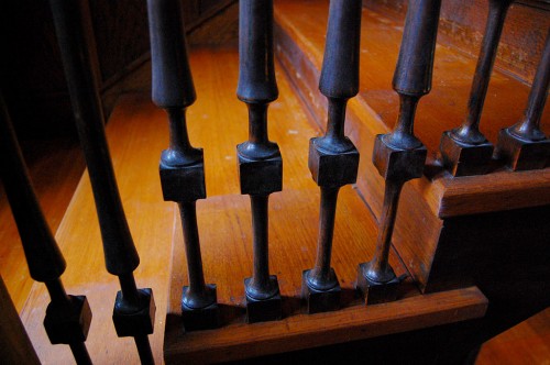
The house appears to be well-maintained. I’ve been in so many depressing and falling-down buildings of late that it felt good to be in one that had been taken care of.

330 N. Lorimier Photo Gallery

Here’s a selection of photos showing the house and the items for sale. Click on any image to make it larger, then click on the left or right side to move through the gallery.

MO Dry Dock Building Gone

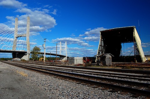
Remember when you were a kid and lost a tooth? Your tongue kept going into the gap like it couldn’t believe something was missing. I had the same experience when we drove down Aquamsi Street south past the Bill Emerson Memorial Bridge. (Click on any photo to make it larger.)

Something was missing.

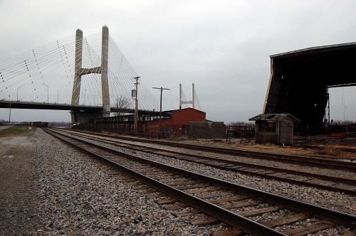
Old MO Dry Dock building torn down

I happened to be looking at an earlier post of the Missouri Dry Dock area and saw what it was: the old brick building at the north end of the dry dock was gone. March 22, 2010, was a lot cloudier day than Oct. 20, 2011, when the top photo was taken..

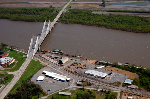
Only a foundation on April 17, 2011

I don’t know exactly when it was torn down, but all that’s left is a foundation north of the large yellow building and south of the bridge in this aerial taken April 17, 2011. The building on the left is SEMO’s River Campus.