Not Big on Beale Street

Memphis 11-23-2015Our family generally headed north to St. Louis instead of south to Memphis, but I suggested that Curator Jessica fly out of Memphis on the chance that I might drive home to Florida for Thanksgiving towing a ski boat for Kid Adam. I haven’t had a chance to check out the boat’s motor and make the trailer roadworthy, so I’m sticking to Cape for Turkey Day.

About the only thing I remember about Memphis is that Dad always warned me not to honk my horn in that town because the noise ordinances were so strict the cops would ticket you for being overly horny.

Mud Island was closed
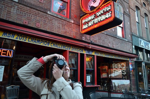
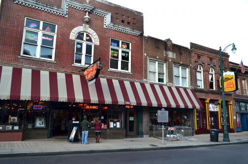
Memphis 11-23-2015I had hoped to show Miz Jessica Mud Island, but it was closed for the season. We didn’t have a lot of time before her plane left, and we were already down in the Beale Street area, so we elected to park at the Beale Street Landing and walk up to the street known for the Blues and W.C. Handy for a quick bite to eat and to soak up the ambiance.

Let me say I was less than impressed. She and I split a sampler platter that contained some onion rings that were so tough you couldn’t bite your way through them; nachos consisting of a few dry threads of pulled pork BBQ glued to taco chips with plastic cheese, and two nondescript chicken wings.

I had REAL barbecue at the Dixie Pig in Blytheville the next day. Instead of Beale Street onions that could be used for shoe leather, The Pig made theirs with Texas sweet onions that were tender and as sweet as eating an apple.

I felt like a rube
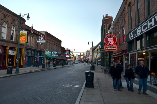
Memphis 11-23-2015I don’t like places like Disney World because they have no soul. I feel the same way about modern Key West. I preferred it when it was a scruffy Navy town with pawn shops every other door and full of disreputable types who had let social gravity sweep them to the southernmost part of the continental U.S.

I know I didn’t give Beale Street enough time, but walking around there made me feel like a rube. I don’t like feeling like a rube.

Reflecting on the Real World
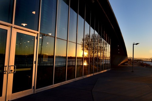
Memphis 11-23-2015I felt much more at home when we hit our parking lot just as the sun was going down and the Mighty Muddy Mississippi River was reflecting in a window. Ahhh, back to the Real World.

It’s that time of year again

Buy From Amazon.com to Support Ken SteinhoffEverybody is getting all excited about Black Friday, Cyber Monday and Overspend Wednesday (I made that one up), so I’m going to join the din.

If you are going to shop Amazon anyway, please go to my blog and click on the big red ‘Click Here’ button at the top left of the page (or, this one). That’ll take you directly to Amazon with a code embedded. If you buy something, I’ll make from four to seven percent of your purchase price without it costing you anything.

Think of it as being your painless Christmas present to me.

The Night Belongs to Me

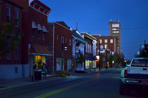
Broadway 11-13-2015_2464I like roaming the streets at night. Maybe part of it is that I don’t like to get up early. Even most of my bicycle riding was done as the sun was going down and later. The streets were quieter. People weren’t in as much of a hurry. It was fun cruising through neighborhoods chatting with people walking their dogs, pushing baby strollers or rolling their garbage cans to the curb.

If you saw a flickering light in a darkened room, you knew the residents were watching TV; if the light was steady, they were on their computer. If their windows were open, you could smell their dinners cooking, and maybe even guess what part of the country or world they were from by those fragrances.

After I dropped off my late-night meeting or sports photos at The Missourian (so I wouldn’t have to get up early in the morning to do it), I’d roam up and down the streets and alleys listening to police calls, talking to the night watchmen or just enjoying a city asleep. The cops all knew my car, so they never stopped me to see if I was up to something.

View from Fort A

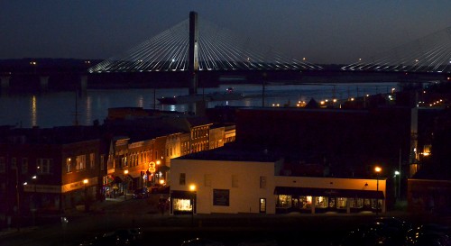
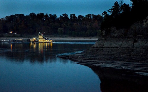
View from Fort A 11-13-2015The view from what had once been Civil War Fort A at the end of Bellvue is arguably the prettiest view of Cape Girardeau. I wish I had been there 15 minutes earlier so the barge would have shown up better in the reflections of lights on the river. Of course, had I been there 15 minutes earlier, the boat would have been below the bridge, and it wouldn’t have mattered what the light level was. As it turned out, I had to wait about five minutes for it to get where it is here.

KFVS antenna farm

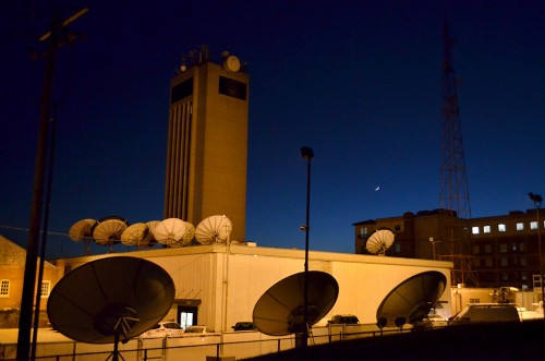
KFVS at night 11-13-2015Coming down the hill from Bellvue on North Lorimier from Fort A, my eye was drawn to the KFVS tower and the antenna farm behind it. I drove past, wondering if it was worth a shot. When I saw the crescent moon over the Marquette Hotel. I circled the block and was lucky enough to find a parking spot just about where I needed to shoot. (You can click on the photos to make them larger, by the way.)

A car pulled in across the street just about the time I got out of mine. The driver must have wondered what I was up to, because I could sense he was watching me. Finally, when I opened the door to get back into my van, he got out and walked across the street. I didn’t stick around to see if he went into KFVS or walked down the hill to what used to be the the N’Orleans, the brick building on the left.

The antenna on the right is a twin to the iconic one on the last hill on Highway 61 coming into Cape from Jackson.

Liver and Onions and Tower Rock

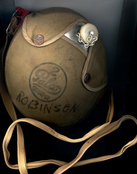
K Robinson canteenThursday was a pretty productive day. Back in 2013, I wrote about finding Keith Robinson’s Boy Scout canteen. Mother kept bugging me, “When is that boy going to come by and pick it up?”

Keith, my go-to guy for all things railroading emailed he was going to be escaping Kansas City for a few days to come to Cape. FINALLY, a chance to get rid of this crazy canteen.

We made arrangements to meet at the Jackson at the Cape County History Center. It turned out that he and his dad knew some of the people mentioned in the museum’s exhibits.

Journey to the Land of Liver & Onions

Tower Rock at dusk 10-22-2015Museum director Carla Jordan shares my love of liver and onions, so she said she’d buy dinner at the Mississippi Mud in Altenburg if I’d drive. I rhapsodized about how good the Mud’s L&O were on September 11. Well, they were even better Thursday night. The meat was so tender you could cut it with a fork; the onions were grilled just right, and my two sides of cheesy mashed potatoes and corn couldn’t be beat.

Carla and I shared our table with Gerard Fiehler and Lynn Degenhardt; two more museum folks filled in the table next to us. Lips were smacked and plates were cleaned. I can see myself making a pilgrimage to Altenburg every Thursday night until I get my fill of Innards and Onions.

I can’t go to East Perry county without dipping down to Tower Rock. Carla and Gerard piled into the van and we got to The Rock at the crack of dusk. Our timing couldn’t have been more perfect. Click on the photo to make it larger.

Here’s why I don’t wade

Tower Rock 10-19-2015The river’s going to have to fall about another three feet before you’ll be able to walk out to Tower Rock.

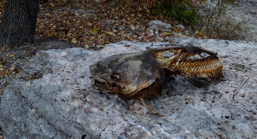
I was up there two days earlier hoping the leaves had turned, but they still needed a few more days of cold weather. This catfish was sitting on the rock where Mother used to scoop up some of the best persimmons to ever hang on a tree.

My thought was, “If the fisherman didn’t keep this guy because he was ‘too small,’ I don’t want to stick my feet into any water that would hold his big brother.”

The Confluence

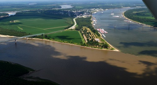
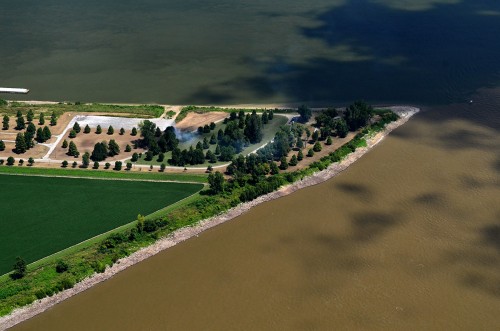
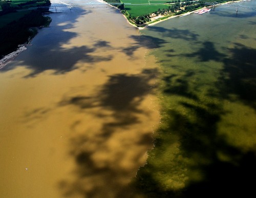
Aerials Cairo area Confluence of Mississippi and Ohio Rivers 08-13-2014There was some discussion on a Facebook group about the confluence of the Mississippi and Ohio Rivers at the south end of Illinois at Ft. Defiance. That’s been one of my usual stops every time I’ve passed through, going to or from Cape.

Pilot Ernie Chiles and I picked a bad day back in August 2014 for this particular project: we couldn’t shake the clouds that kept covering the mingling of the waters. In this photo, the Mississippi is the brown mass snaking from the left side of the frame and crossing across the bottom. What’s left of Cairo is in the top middle. The bridge carries traffic from Illinois to Kentucky.

The Muddy Mississippi is higher than the Ohio and it’s “holding back” the greenish waters of the river on the right. Click on the photos to make them larger.

Pushing the Ohio

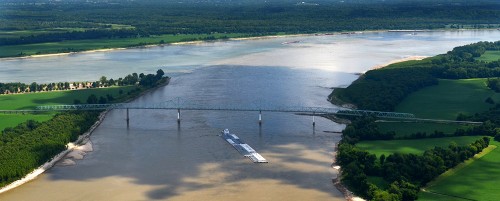
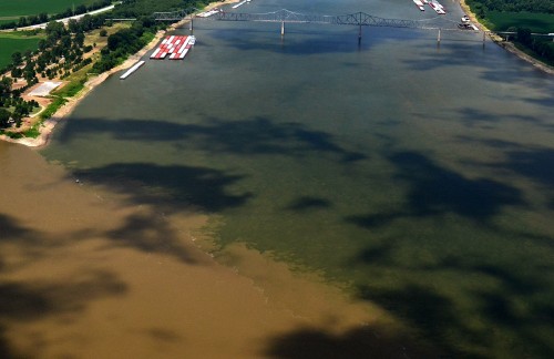
Aerials Cairo area Confluence of Mississippi and Ohio Rivers 08-13-2014The view looking down the Mississippi shows the muddy water pushing the Ohio way over onto the east side of the river. This bridge links Illinois to Missouri.

Southernmost point of Illinois

Aerials Cairo area Confluence of Mississippi and Ohio Rivers 08-13-2014That tiny point of land is as far south as you can go in Illinois. The Mississippi is at the bottom, and the green Ohio, looking almost like a field of grass, is meeting it at the top.

War of the waters

Aerials Cairo area Confluence of Mississippi and Ohio Rivers 08-13-2014The intersection of the two rivers is a bit roiled because a tug steaming northbound up the Mississippi stirred things up.

That’s why it’s called The Big Muddy

Aerials Cairo area Confluence of Mississippi and Ohio Rivers 08-13-2014The Mississippi is divided into three regions. This marks the beginning of the Lower Mississippi. Surprisingly, at the confluence, the Ohio is the bigger river at this point, based on flow, with it’s long-term mean discharge at Cairo being 281,500 cubic feet per second. The Mississippi, measured just upriver at Thebes, is 208,200 cubic feet per second.

On this day, though, the Mississippi was higher and dominant.

You can see two of my favorite Ft. Defiance photos here. One was taken in 1968, the other in 2010.