 When Curator Jessica made her initial pilgrimage from Ohio to Missouri last December, I convinced her that every first-time visitor to St. Louis’ Gateway Arch has to lick the stainless steel icon.
She was a mere child of 29 at that time, and gullible.
Not falling for it at the state line
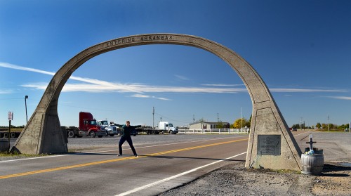
 When I asked David Kelley of Steele, Mo., if the old concrete arch over U.S. 61 at the Missouri – Arkansas border was still standing, he said, “Yep. It’s still there. It’s only eight miles away, let’s go see it, then go down to the Dixie Pig in Blytheville for lunch.”
U.S. Route 61 is the official designation for the highway that runs from New Orleans, past Memphis, past Cape Girardeau and St. Louis, ending up in Wyoming, Minn.This section through Arkansas was once a dirt trail called the North-South Road, and was in such poor shape that it might take as much as a full day to cover 15 miles.
Highway 61 called the Great River Road because it parallels the Mississippi River a good part of its run. It also answers to the name “Blues Highway” because of the path it takes through Blues country.
Now that she’s put 30 birthday candles in her back pocket and done several thousand Steinhoff Road Miles, Curator Jessica is older and wiser. She wasn’t falling for the old Lick the Arch trick twice. She did agree to risk death by posing under the arch so you could get an idea of its scale, roughly 15 feet high and 20 feet wide at the base.
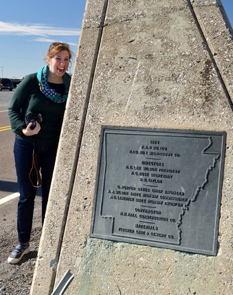
Almost a lick
 I didn’t realize until I was editing the photos that she DID fake an almost-lick for the camera. I guess that’s close enough.
The arch was created by the Mississippi County Road Improvement District in 1924. Check out what the National Registry of Historic Places says about the arch and what Arkansas highways were like in the first quarter of the 20th Century. It’s a fun read and will make you appreciate modern roadways.
I love this part: The location of the arch on the directly south of the Arkansas-Missouri state lines had a somewhat strange economic effect. Highway 61 runs primarily north to south, but at the state line the road runs east to west for a distance of approximately one-half of a mile. The state line is located directly north of the section of highway.
A lower gasoline and cigarette tax in Missouri led to a concentration of businesses on the north side of the highway. At one time there were as many as fourteen service stations lined up along the “line”. Along with the service stations came several nightclubs and small gambling houses. The area around the arch became known as “Little Chicago” because of the type of activity that went on there. A long-time resident of nearby Yarbo, Arkansas, once said of the arch, “It was a good place to go while the wife and kids were in church.”
Click on the photos to make them larger.
