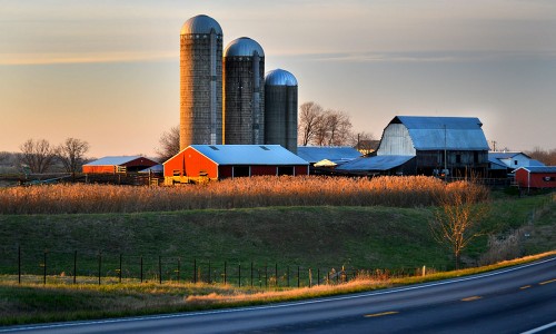
 I was racing the dark Monday to shoot the remains of the Silver Dollar Tavern on Apple Creek when I popped over a hill on Highway 61 south of Old Appleton and saw this farm in the sunset. I did one of my patented U-turns to capture the golden glow. That’s the reason photographers call the hour after sunrise and before sunset the Golden Hours.
I had some tighter shots, and I debated cropping up from the bottom, but I like the way the manmade yellow highway divider lines echo the color of the backlit grasses.
Keeping track of where I am
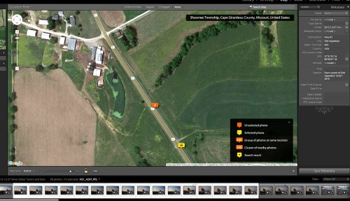 One of the challenges in shooting lot of pictures is that you sometimes forget where you were or there aren’t clearly identifiable clues to help you orient yourself.
You can buy GPS attachments to plug into your camera, but they are bulky and expensive. Kid Matt came up with a cheaper solution. Since I already have an Android phone on my belt all the time and an iPad in the car, he suggested I get a program called Geotag Photos Pro that would capture the GPS track of where I’ve been. Matching up the track time with the filestamp time associated with a photo, can tell you where it was taken.
It sounds complicated, but I was happy to find out that it is harder to explain than to use. The map above shows where the photos were taken. The yellow marker that has the 16 means that 16 frames were exposed near there. The orange 4 represents four frames taken with a second camera body. They were both taken from the same location, but the camera times were off by a few seconds, which caused them to appear to have been taken at different locations. I’ll synchronize the devices better before I do this again.
It’s going to help out a lot now that I’m spending a lot of time roaming around in rural areas I’m not really familiar with.

