Bridges and Goodbyes

I really enjoyed my visit to Cape, but it was time to get back to Florida. Judge Bill Hopkins said he had gotten a call from Wife Lila asking how long I had to be gone before she could have me declared legally dead.

Since I was headed that way, Mother said she’d follow me in her car (for the record, she may be 90, but she’s still a good driver) over to her trailer on Kentucky Lake so I could help her turn on the water and check for any problems.

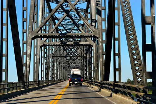
Not surprisingly, it took me longer than anticipated to get everything loaded in my van. Because of the late start, we didn’t waste any time sightseeing along the way. I did bang off a couple of frames as we headed over the Ohio River bridge leaving Cairo for Wickliffe. You can tell that it’s about as wide as the old Cape Mississippi River Bridge (plus it’s got that crazy 90-degree bend on the Kentucky end).

35 years
The pipes at the trailer froze winter before last, so she had to have them replaced. When I went to turn on the water, nothing happened. After much head scratching and mosquito swatting, I discovered that they had moved the main shutoff valve. I decided to stay there overnight instead of pressing on to Nashville as I had planned.

By coincidence, we were there on August 7, 35 years to the day when Dad had a heart attack at the lake and died. When folks posted stories this week about it being the week that Elvis died, I tell ’em that my dad died that week too; the difference is that I don’t miss Elvis.

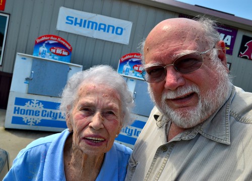
We were going to eat breakfast, but the place we planned on stopping at was closed, so we said our goodbyes at a gas station. I’m getting a little better at the teenage girl self-portrait thing. My arm must be getting longer.

More narrow bridges

I’m glad I’m not pulling a travel trailer or driving an 18-wheeler. These bridges linking sections of the Land Between the Lakes are narrow and showing their age. At one time, I could have told you what body of water these cross, but I have long ago jettisoned that knowledge.

I covered the aftermath of the Silver Bridge collapse on Dec. 15, 1967. The eyebar-chain suspension bridge linking Point Pleasant, W Va., and Gallipolis, Oh., failed while it was filled with rush-hour holiday shoppers. Forty-six people died in the icy waters of the Ohio River.

When I cross a bridge with a lot of rust on it, I wonder whether it’s cosmetic or whether it’s another Silver Bridge waiting to happen.

Photo gallery of Kentucky bridges

I think the shadows of the bridge structure are interesting. I have to admit I wasn’t doing any careful composing. I was just holding the camera with one hand and trying to keep from scraping the bridge railing with the other. I didn’t see the shadows until I saw them on the computer screen. Click on any photo to make it larger, then click on the left or right side to move through the gallery.



Murray State’s Shoe Tree

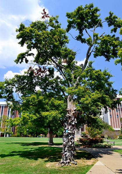
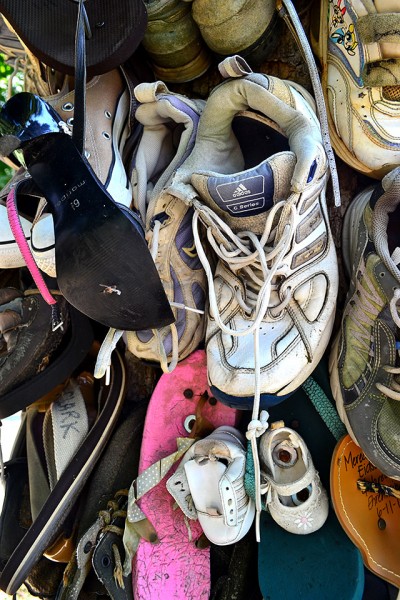
Ever since I ran across the Perkins Shoe Tree (OK, it’s really a pole, but the pole was once a tree, so I’m going to say it still qualifies as a tree), I’ve been wondering how many other ones there are out there. When I spotted a newspaper clipping about the Murray State University Shoe Tree, I decided to make a detour on my way back home.

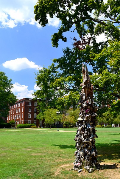
Located behind Pogue Library

I mentioned being a bit unnerved by the clown sign on the edge of town. I left my phone charger in Cape, so I had to stop at a Big Box store to get a new one. Neither did the young cashier nor an older woman at the door had ever heard of the Shoe Tree. Out in the parking lot, I did a little web research and found that the tree was supposed to be near Pogue Library. I put that in my GPS and headed out.

Unfortunately, when I got to the university, it seemed like every street I needed to turn down had temporary barricades on it. I went into a building that had all kinds of security monitors behind a desk, but there was nobody around to ask. The door that said I was supposed to show ID before entering was propped open. Trusting folks, those Kentuckians.

Skateboarders point the way

Out in the parking lot, I flagged down some teenage skateboarders who gave me vague directions. That got me close enough to ask some coeds in another parking lot who said they didn’t know the names of the streets, but I should take a right, another right before the McDonald’s, then curve around until I got to the library. They were right. Even found a parking spot in the shade.

More like a snag than a tree

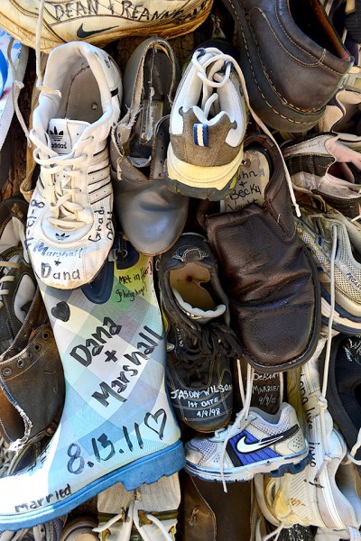
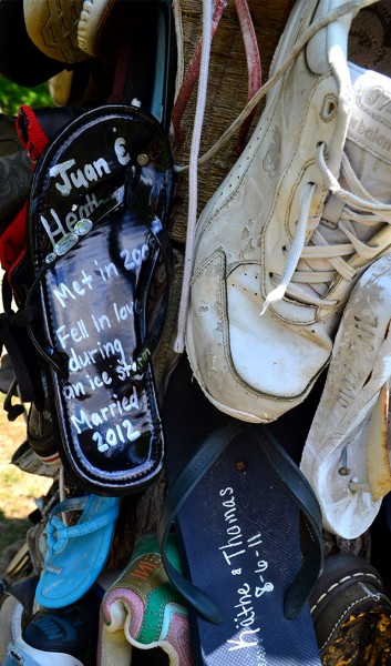
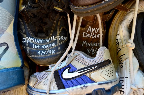
The legend is that if two students who met at Murray State University, fall in love and then marry, they will have good luck if each partner nails a shoe to the tree. Some folks have returned to tack a baby shoe to the tree when they’ve started a family. Nobody seems to know when the practice started.

This isn’t the original tree. The first one, the story goes, was struck by lightning and burned. This one has had the branches lopped off and appears to be on its last legs (roots). Some accounts say that even this tree has been struck by lightning “due to a high zinc content from the nails.” I tend to discount that theory. There are lots of taller metal objects around that would provide more enticing targets for Thor.

Las Vegas? Chicago?

Stefanie, the self-proclaimed List Queen, debated going to Las Vegas to celebrate her first wedding anniversary. Her hubby was pushing for an expensive Chicago restaurant.

“So what the heck are we doing? We’re going to nail our shoes to a shoe tree in Murray, KY (#185 on my list). What kind of redneck tradition is that, you may ask?”

How do you do it?

Stefani continues, “I thought there would be a whole process of verifying that we were students and that we actually did indeed meet at Murray. I thought we’d have to be escorted to the tree and someone would take our picture. But when Blake called, they were like, “Yeah, just show up and nail your shoes to the tree.” Awesome.

Southeast Missouri State University has its Gum Tree at the top of Cardiac Hill, so I guess it’s only right that Murray State would have a shoe tree.


Eyeing The Rock

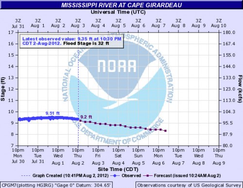
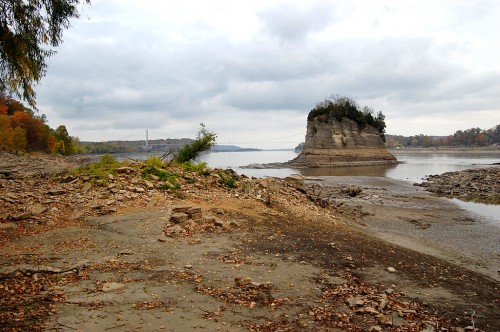
The Mississippi River keeps creeping lower and lower. On July 19, the Cape river gauge read 11.23. On August 2, it was down to 9.35. That’s not good enough. It needs to be at 7.0 feet in Cape to be able to walk across to Tower Rock, locals tell me. Here’s where you can check the river stage at Cape. By the way, you can click any photo to maker it larger.

Itchin’ to go

Members of the Southeast Missouri Geocaching fan page are just itching to get on top of Tower Rock so they can claim bragging rights to an exotic cache. If you’ve never heard of the hobby, here’s a website that does a good job of explaining it.

I was going to meet Cacher Randy Friday to see if we thought it was safe to make it to The Rock for the rest of the group on Saturday. Unfortunately, I have to swing by LeGrand Bros. Transmissions first. My check engine light came on and I wanted to make sure it wasn’t something serious before being That Guy stuck on the side of the road with his hood up and a mournful expression on his puss. You might recall the sad story of my transmission from last year.

Anyway, a nice guy hooked up a $9,300 computer to my car, went for a short test drive and said I needed a new throckmorton that bolts onto the franjipannni. The good news is that it’s on the exterior of the trannie and shouldn’t take more than two heartbeats and a hamburger to fix. (Once the part gets here, that is.) The best news is that it’s covered under warranty.

So, if Sir Randy gives me the All Clear, I’ll sound the trumpets and a whole herd of folks will be hanging all over The Demon The Devours Travelers on Saturday. If not, they’ll try next weekend. I just won’t be there to see it.

Surely they need a souvenir

Maybe they’ll stop by the Altenburg Lutheran Heritage Center and Museum where they can pick up a souvenir copy of my book on Tower Rock.

FRIDAY MORNING UPDATE

Cacher Randy called around 10 a.m. to say that it’s a no-go. He waded out until the water was waist-deep (deeper than I would have gone) and felt the current “tugging” at him. He decided to turn back. Wise decision. He also noted that the bottom was slippery.

How do I get there?

A reader asked how to get there. This map shows you the scenic way I get to Altenburg on my bike. In my Tower Rock book, I describe the path from Altenburg to Tower Rock this way:

Tower Rock isn’t some place you stop on the way to somewhere else. You have to REALLY want to go there.
You start by passing through Altenburg on Missouri Highwy A.
After going up and down some steep hills, just before you get to what’s left of the German pioneer village Wittenberg (population: two buildings and three people), you’ll see a small sign off to the right pointing to Perry County 460, a steep and washboarded gravel road.
Off to your left, you’ll pass the Texas-Illinois Natural Gas Pipeline bridge, called the longest suspension pipeline in the world. It carries gas from Texas to Chicago.
Not far from there, the road narrows. Now things get interesting if this is your first trip. You’ll make a sharp 90-degree bend to the left and cross over the BNSF railroad tracks and make an immediate right-hand 90-degree turn paralleling the river.  There are no warning devices, so Stop, Look and Listen before getting on the tracks.
The stretch along the river is narrow and there’s a steep drop-off to the water, but you seldom meet a car. Eventually, you’ll come upon a parking area at the Tower Rock Natural Area, donated by Mr. and Mrs. Charles Bussen to the Missouri Conservation Department.


Another Full Moon

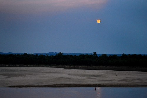
When you’re shooting your second full moon of a visit, it’s probably time to start packing your bags. The moon phase ap on my Droid showed that the orb was 97% full last night, so I told Mother we better be ready to saddle up to shoot it tonight.

We pulled in to the parking lot at the base of Cape Rock to find eight or ten cars getting ready for the free entertainment. Just about that time, a long, long, long southbound freight rolled by in front of us. It kept coming and coming and coming, slowing all the time. Finally, with the last three empty hopper cars and a pusher engine blocking our view, it stopped. Dead, put-a-penny-on-the-tracks stopped.

We decided to go to the top of Cape Rock, but feared that it would be parked solid. To our surprise, there was only one car parked there, and it moved on, leaving us some prime real estate to watch.

While I was setting up my tripod, a guy on a bike rolled up. We did all the ritual chicken dances that people with similar interests do and got so involved that I didn’t pay much attention to the horizon. I’d look over my shoulder from time to time and think, “Nope, not yet.”

Well, I had misjudged where the thing was going to come up. On one of my shoulder checks, I looked a little more to the south and did one of those, “Whoa! Where did THAT come from?” Of course, I pretended that I had been patiently WAITING for the moon to get 10 degrees out of the water before shooting.

I shot a few frames with the longer lens on my video camera, but I like this one better because it shows how low the river is now. That’s one BIG sandbox down there. The river’s about three feet lower than it was when I shot the little picture above from Cape Rock last fall.

Checked out the casino

When some clouds covered the moon, we headed toward town. I thought maybe there would be some night working going on at the casino, but it didn’t look interesting. I opted not to try for a moon shot from the floodwall and the bridge because I had done those before. I decided to see what the view was like from the Common Pleas Courthouse.

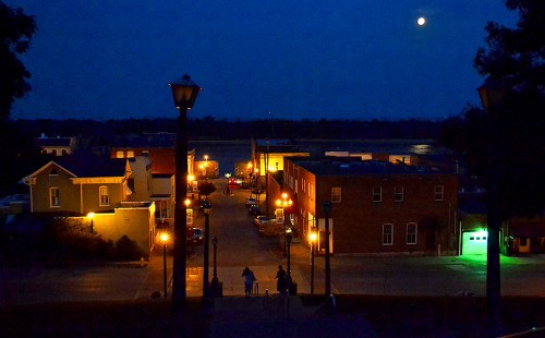
When I came around the corner, the two women going down the steps were standing shoulder to shoulder trying to get a moon photo with their camera phones. I didn’t have the heart to tell them that the puny little flashes built into those cameras weren’t going to do much good at lighting up downtown OR the moon. I didn’t do much better. It was already pretty small in the sky by now.

This view down Themis Street is pretty similar to the one I shot in March of  2010.

I may try this angle for my next full moon shot, but it had better not be taken on THIS trip..