John G. Putz rhapsodized about Oriole in the March 5, 1931, Missourian. The vocabulary and sentence structure would challenge today’s newspaper reader, but he paints an interesting picture of the “picturesque hamlet.” The Missourian’s story had some other information about the area if you are interested. Check out the front page for an account of the gas war that had regular at 14.5 cents and high test going for 17.5.
Perhaps the most poetic name of any town or village in Cape Girardeau County is that of the picturesque hamlet Oriole, which nestles among the rocky hills in the eastern part of this county. Along the banks of the headwaters of Indian Creek, on which Oriole is located, the bird whose name it bears nests in large numbers in swinging branches of the sycamores and elms overhanging the gravelly bed of the creeks.
Postmaster Witter named town
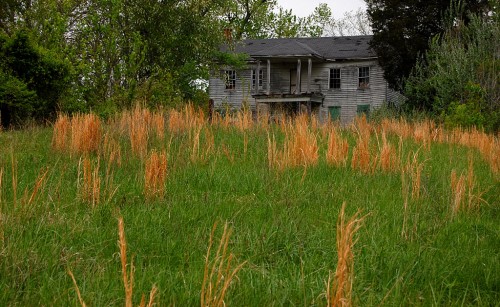 Erastus Witter, teacher, naturalist and philosopher, who was the first postmaster in Oriole, in casting about for a name, chose the name suggested by the graceful denizens of the trees, the orioles, and the postoffice department adopted that name for the office. Up until that time, the place was known as Lanesville, so called after John Lane, a Methodist minister, who had established a trading post or store on the high ridge a mile to the southeast from the present site of Oriole. This store was purchased by Erastus Witter, who later sold it to J. Benton Comer and moved to Seattle, Washington. Comer moved the post office to the present home of J.A. Armstrong, a short distance southeast from the site of Oriole, and the original building forms part of the present mercantile establishment of L. McLain, after several additions had been constructed. The original building was erected about 40 years ago, and housed the postoffice under various postmasters, until the office was discontinued with at the advent of the rural routes.
LaFern Stiver grew up here
 Originally all the land within a wide area, several hundred acres, was owned by the Williams family, the original and first settler by that name, Charles Williams, coming from Virgina about the year 1796. He was the son of Col. Charles Williams, under George Washington, the inspector of arms at Harpers Ferry. The graves of Charles Williams, his consort and several other members of the family are located about 300 yards east of Oriole. George Williams, son of Charles Williams, became his successor as owner of most of the homestead and headright. H.H.M. Williams, son of George, became one of Jackson’s leading merchants, and for years conducted a general store on the corner of Main and South High Streets, where the Jackson Mercantile Company’s store is now located. Sam D. Williams, son of H.H.M. Williams, has a fine farm a few miles southwest of Jackson, and some of his seven sons have families of their own, their children now constituting the seventh generation of the Williams family in this county.
Baptists and sawmills
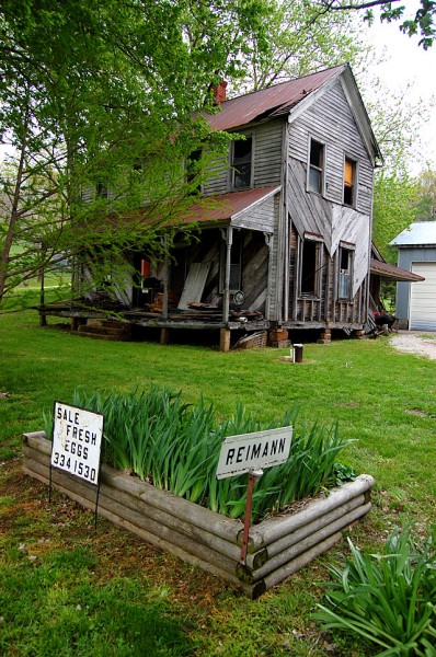 About 25 years ago a small congregation of Baptists concluded to erect a church near the Williams burial grounds, and the members of the Williams family contributed liberally towards the building fund. The church has fallen into decay, however, and is rarely opened for meetings.
A short distance northward from Oriole, down the creek, a large sawmill was formerly located, employing a number of men. The commissary was in charge of Sam Howard, who was widely known as a whittler, skilled with the knife, and could shape remarkable things from wood, such as wreaths, chains, fans and the like. One of his masterpieces, a wreath, carved from butternut wood, consisting of 126 pieces, all dovetailed and mortised together without the use of a nail, tack, bolt or screw, is in possession of a collector of curios in Jackson now.
Gibraltar of golden yellow ochre
 Aside from the historic nimbus that surrounds Oriole like an aureola, the place has an indescribable air of pastoral peace and the added charm of picturesque topography. Between the two branches of Indian Creek headwaters juts out a miniature Gibraltar, the precipitous sides of which are composed of a golden yellow ochre, while the less steep hillsides are crisscrossed by the feet of domestic animals. All the “hog-back” ridges still bear the remnants of a once dense forest. In the deep recesses from which in flood-time emerge turbulent cataracts, formed by the water rushing down the steep sides of the gulches, comes the echoing repetition of every loud word spoken or song wafted into the air, while from the wood-crested ridges comes a baffling, sweet melody, floating on the current of the far wind.
In the west descends the golden sun to rest, while the land is sinking into the calm which evening ever brings to these hills. The oriole sends out it evening farewell song, and up McLain’s Hollow, down toward McLain’s Chapel or up toward the fern-covered saw-tooth ridge to the east, clatters the motor disturbing the spirit of the times long ago that hovers over the peaceful valley and its congenial inhabitants

