Family Dollar Store Site

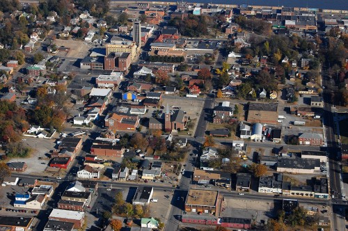
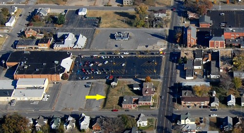
Aerial of Sprigg and William area 11-06-2010When I was up in the steeple of St. Mary’s Cathedral the other day, I noticed land being cleared on William west of Sprigg. It’s one of those things where you say, “Something’s different, but I don’t know what.”

Here’s an aerial taken November 6, 2010, showing the area. The yellow arrow marks the spot. William Street runs from the bottom of the frame to the top of it, and we’re looking east toward St. Mary’s. The building to the left of the big black parking lot houses Fred’s Super Dollar Store and the Save-A-Lot food store.

Click on the photos to make them larger.

Site will be a Family Dollar Store
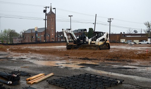
Family Dollar Store site 04-14-2014A November 25, 2013, Missourian business column reported that “an acre of land that includes four properties on William Street between Sprigg and Ellis streets has been sold to Family Dollar store and the deal is closed, according to Thomas M. Meyer of Exit Realty. All the properties now are commercially zoned and will be demolished to street level for the building of Family Dollar.

It’ll be interesting to see if the project continues in light of news stories that “Family Dollar closing 370 stores and lowering prices after revenue falls 6%.”

Should have shot in when weather was good
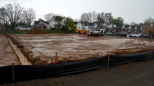
Family Dollar Store site 04-14-2014I should have gone from St. Mary’s to the vacant lot on a day with the temps were in the high 70s and the sky blue.

I procrastinated, though, and shot these when the wind was gusting, the thermometer was heading south into the low 40s and my bald head was being pelted by rain trying to get up enough gumption to turn to sleet.

This photo was taken from an alley on the east side of the property looking west toward the houses on Ellis.

The Quarry from the Top

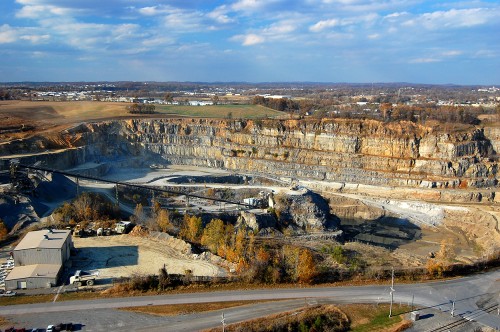
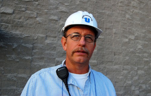
 Buzzi Unicem plant manager Steve Leus 11-10-2010Without thinking I had a chance in the world of success, I approached Buzzi Unicem plant manage Steve Leus in the fall of 2010 to ask for a tour of the cement plant and quarry. That usually results in months of getting bounced from corporate type to corporate type, ending up in a “No.”

I showed up in Steve’s office with a stack of prints I had taken over the past 40 years from the air, from inside the caverns, from the quarry’s edge, and of the plumes of white particulate that used to belch from the stacks of the plant. We had a great conversation, then he handed me a hard hat and we were on our way. THAT’S the kind of manager I like to deal with.

There are some stories that paralyze me because they are special to me. This is one of those. I kept putting off and putting off publishing it because I wanted to research the history of the plant that has changed names many times, boil down Steve’s explanation of how rock  becomes cement and do it right.

Let’s pull the trigger

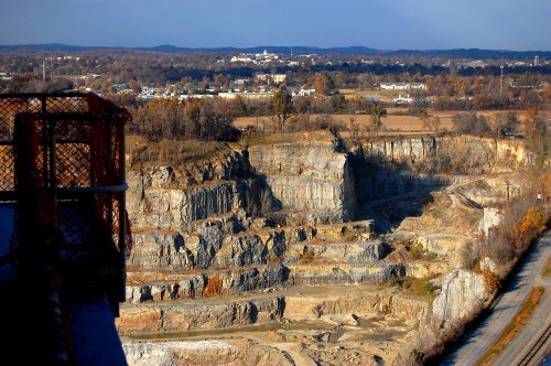
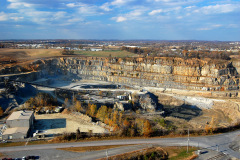
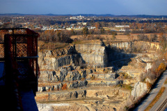
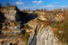
Cape cement plant and quarry 11-10-2010Today, more than three years later, I figured I’d better pull the trigger on this puppy and start publishing it in bits and pieces. I am NEVER going to do all that research and transcribe the paper and digital notes I have. Let’s get real: I’m a photographer, not a historian. I’ll let the photos speak for themselves.

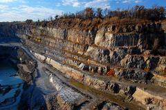
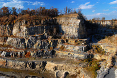
Part One will show the huge hole in the ground from the top. Well, not ALL the way from the top. I’ve got a bunch of aerial photos over the years that will run later.

Sometime in the future, I’ll publish photos taken from the bottom of the quarry including the tunnels that you are driving over when you are on Sprigg Street.

Unfortunately, NOBODY, Steve said, is allowed in them. There’s no danger of Sprigg Street collapsing, but safety regulations are a lot more stringent than they were a hundred years ago.

The old Blue Hole

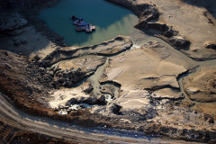
Cape cement plant and quarry 11-10-2010If I remember my history and what Steve told me, the rounded area on the far right was what was popularly known as the “Blue Hole,” called that because of the color of the water that filled it. At one time, this area was two quarries. When the caverns were blown, it became one big hole.

You can see the dome of SEMO’s Academic Hall sticking up in the center of the photo.

Earlier stories about the quarry and cement plant

Quarry photo gallery

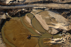
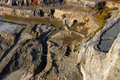
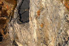
Some of the photos look a bit repetitious, but there are subtle difference in all of them. Click on any image to make it larger, then use your arrow keys to move through the gallery. Thanks to Steve for sharing a part of Cape that has fascinated me since I was a kid.

It WAS the Junior High School

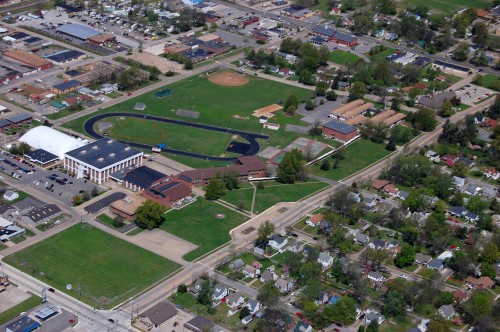
Aerial Photos of Central High School on Carruthers Ave 04-17-2011When I asked readers to help me identify a building yesterday, it didn’t take long before Dennis Mize, Jim Feldmeier, Charlie Holt, Tim Ludwig, Keith Robinson and Dave let me know that it was Central Junior High School. This aerial isn’t from the same angle, but you can see the boxy shape and ramp that confirm what the guys were saying.

Here’s a new mystery

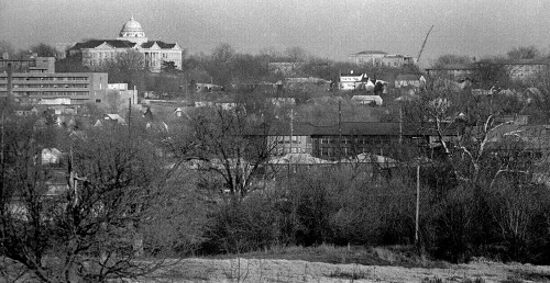
SEMO Academic HallWhen Neighbor Bill and I looked at this picture, I said I thought the crane was probably working on the highrise dorms that would have been north and east of Academic Hall. He said he woke up at 3 a.m. with the revelation that the crane was working on the KFVS-TV tower across from The Missourian.

I’m not convinced. If that’s the case, then what is the building to its left that has a rounded rooftop? Click on it to make it larger, if that helps.

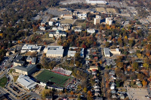
SEMO campus with dorms

Aerial Southeast Missouri State University 11-06-2010Here’s a a 2010 aerial of the SEMO campus with the high rise dorms in it for comparison.

Downtown aerial

Aerial Broadway - Sprigg - Independence 11-06-2010_9143This aerial shows the KFVS-TV tower at the top left. The square is bounded by roughly Broadway – Themis – Sprigg and Main Street.

Common Pleas Courthouse 1964

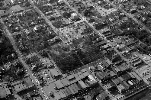
Aerial Common Pleas Courthouse 04-14-1964This 1964 aerial centered on the Common Pleas Courthouse was taken before the KFVS-TV tower was built. There’s a parking lot across from The Missourian where it will be built.

I hope one of these will help you figure out the mystery building.


St. Mary’s Safety Patrol

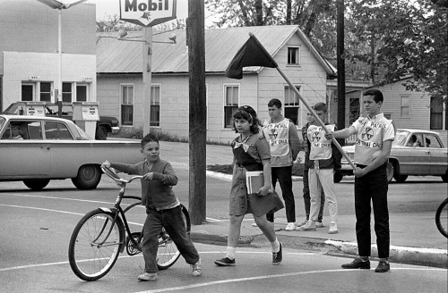
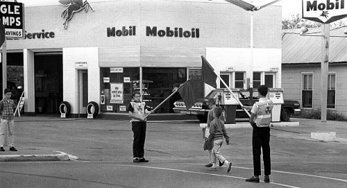
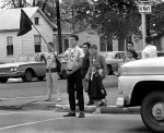
It took a minute to figure out which school safety patrol these boys belonged to. The gas station and houses looked a little familiar, but it didn’t have the feel of Broadway about it. I like that you can see the driver in the car on the left and that the girl’s right shoestring is flapping.

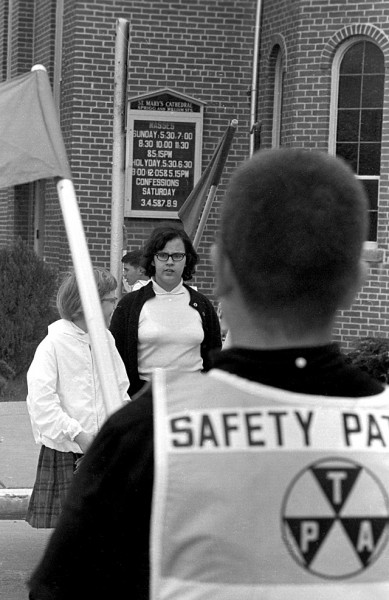
St. Mary’s Mass schedule

The frame with the St. Mary’s Cathedral school in the background helped nail it down. It was the corner of Sprigg and William that I’ve written about before.

Sherer’s Mobil Service Station

The sign above the door says S.H. “Bud” Sherer Dealer. (It might be “Bub.” It’s hard to tell at the angle).

Station and houses are gone

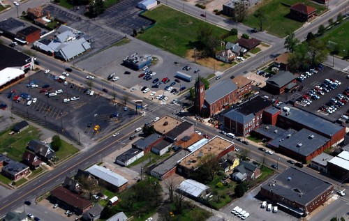
This April 17, 2011, aerial shows that the station and the houses on the corner are all gone.

Photo gallery of St. Mary’s School Safety Patrol

Click on any photo to make it larger, then click on the left or right side of the image to move through the gallery. Here was Trinity Lutheran School’s Safety Patrol, including a video.