 The Missourian’s big annual extravaganza was the Achievement Edition, published after the first of the year and looking back at the previous year’s accomplishments. We started working on the copy and photos well before Christmas.
Back in the old days before computers, we didn’t have filenames to keep track of stories, headlines and layouts. We used “slugs,” a line of lead type with a descriptive title. If the reporter was sending the story in several “takes” or pieces, then he or she would create a slug that might say, “murder1, murder2.” Since the composing room would occasionally miss taking the slug out, it was a good idea not to use titles that could be embarrassing (like labeling the religion news “god junk”).
Because the Achievement Edition copy was done so far in advance, it was given an additional slug “Atomic” so it wouldn’t get crammed into the daily paper. Or, at least that’s the way I remember it.
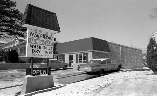
One Christmas break when I came home from Ohio University – it was probably 1967 – Editor jBlue asked if I would have time to roam all over the region shooting buildings like The Wishy-Washy Laundr-O-Mat. The 1968 City Directory says it was at 1526 Independence and that Homer R. Dickmann was the manager. At five bucks a shot, plus mileage, I jumped at the opportunity.
Start at the outside and work in
 In those days, The Missourian was a regional paper. My negative sleeves said I went north as far as St. Genevieve, as far south as East Prairie and as far west as Lutesville. jBlue, always cost-conscious, instructed me to start at the far ends of the region and work inward toward Cape “so I don’t have to pay you to drive the same roads more than once.”
I was told to shoot any commercial buildings that looked new or remodeled and a representative sampling of any new homes that looked “expensive,” defined as costing more than $25,000. By the time I got done with the project, I could have qualified as a tax assessor.
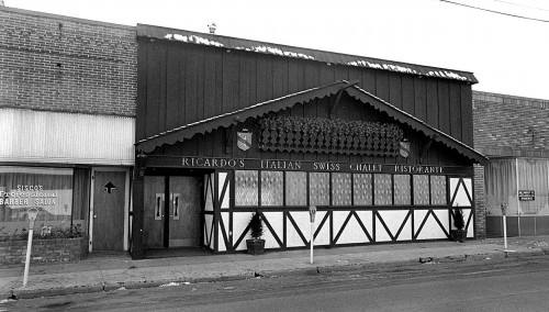
I must have thought Ricardo’s Italian Swiss Chalet Ristorante looked recently spiffed up. The City Directory says it was also known as Rich House Inc. and was located at 731 Broadway. It was flanked on the left by Sisco’s Professional Barber Salon (Wm. D. Sisco), and optometrists Joe L. Mosley and James A. Drace on the right.
Sterling replaced the St. Charles Hotel
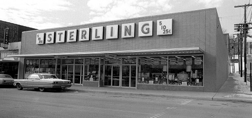 The Sterling store replaced the historic St. Charles Hotel at the corner of Main and Themis. I photographed it being torn down.
Personal Finance Loans
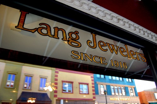
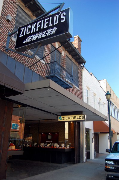
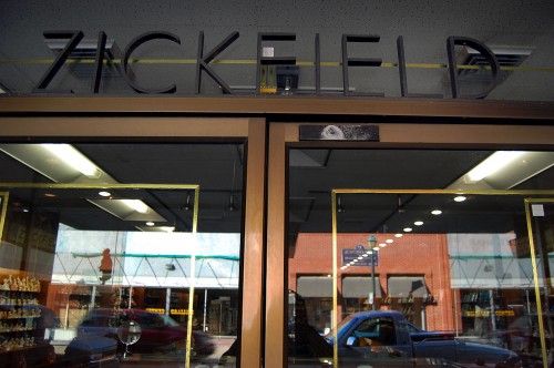
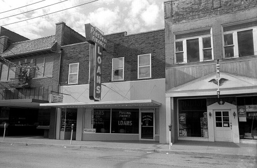 John H. Jarrett was listed as manager of Personal Finance Loans, 31 Main Street. The other buildings include Zickfield’s Jewelers, Tony’s Jewelry and Gift Shop and the Sweet Shoppe.
Eggiman’s
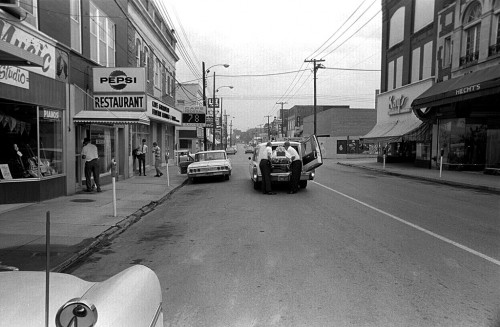
 Skinner’s Barber Shop must have had a short life. It doesn’t show up in the 1969 City Directory, and there is a sign in the window that says “For Lease, Inquire at Eggimann’s.”
Eggiman’s Authorized Dealer of Maytag and Admiral Appliances (Richard L. Eggiman, mgr) was at 225 South Plaza Way. That’s my old 1959 Buick LaSabre station wagon parked in front of Eggiman’s.
Swann & Son Garage
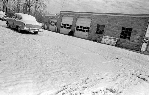 From the off-kilter angle of this photo, I wonder if I might have just changed rolls of film and this was a shot where I was advancing the new roll of film to get past the leader. Swann & Son Garage (C. Elwood Swann) was located at 430 William Street.
Missourian Litho and Printing
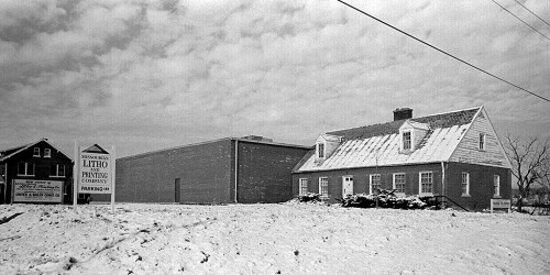 Missourian Litho and Printing Co. (John Beaudean) was at 500 William.
Cape Chiropractic Clinic
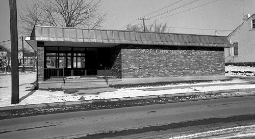 Cape Chiropractic Clinic, 726 Independence, was occupied by Drs. Wm. D. and R.M. Edwards.
Dr. M. Allen Brock
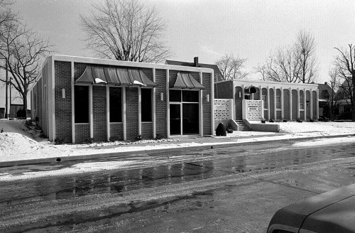 The building on the right has a sign large enough to read that says “Dr. M. Allen Brock – Chiropractor.” The City Directory has Dr. Brock’s address as 148 S. Ellis, but this doesn’t look like Ellis to me. I can’t read the sign on the building on the left. If I had to guess, I’d say this is Independence.
Ford’s Meat Company
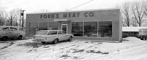 Ford’s was located almost directly across from the Steinhoff, Kirkwood and Joiner Construction Co. on Hwy 61 near Sprigg Street. Managers were Bessie N and Lloyd N. Ford.
Power substation
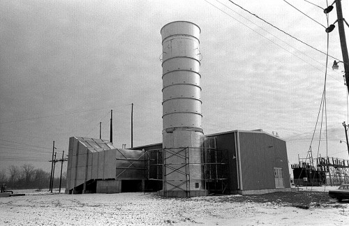 I think this might be the power substation located on the east side of old Hwy 61 that leads to the Diversion Channel boat ramps. It has been expanded in recent years and is protected from flooding by a huge dike around it.
Photo gallery of Cape and St. Genvieve buildings
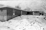
Some of the negatives were in sleeves that said “Cape;” a few, though, said “Cape – St. Gen.” I’m going to assume that the ones with snow in them were Cape. I didn’t bother to try to identify the residential buildings because The Missourian’s microfiche in Google was missing the dates when the Achievement Edition ran. You’ll have to give me your best guess if you see something that looks familiar. Click on any photo to make it larger, then click on the sides to move through the gallery.
If there is interest, I’ll scan buildings from East Cape, Scott City, Illmo, Charleston, Bertrand, Lutesville, Marble Hill, Chaffee, East Prairie, St. Mary, Perryville, Old Appleton, Oak Ridge, Fruitland, Brewer, Thebes, Olive Branch, Tamms, Delta, Bloomfield, Aquilla, Diehlstadt, Oran, Morley, Benton, Kelso, Delta, Advance, Patton and Brownwood. Oh, and I just found another sleeve of Cape buildings. As you can see, there isn’t much of Southeast Missouri I haven’t prowled. Unfortunately, I won’t have any IDs on the buildings. I’ll be lucky to get the town right.


